Pittsburgh Weather: Cold Temperatures Settle In Wednesday Night
PITTSBURGH (KDKA) - Good morning!
The weather calms down today with no advisories or warnings, it's the little things, right?
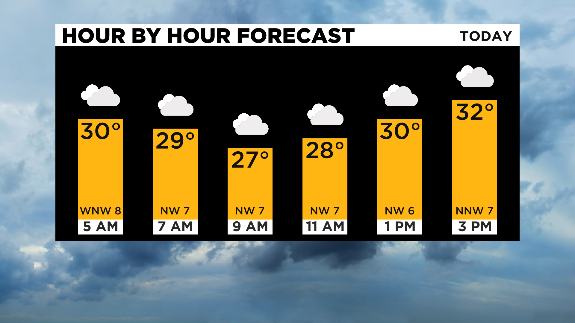
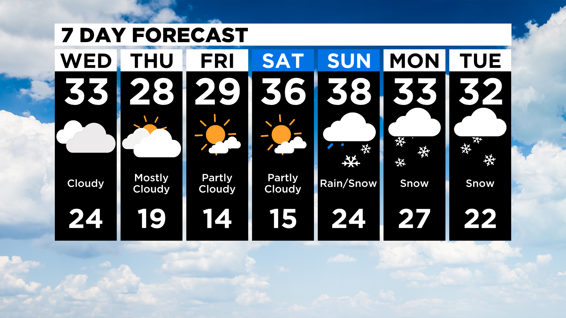
While highs today will be in the mid-30s, afternoon highs will be near 30 degrees with temperatures ticking down for most of the day.
WEATHER LINKS:
Current Conditions | School Delays & Closings | Local Radar | Weather App | Photos
The cold really settles in tonight with us seeing our daily low just before midnight and Thursday morning lows likely in the teens. The cold weather remains in place through Saturday morning with Thursday and Friday highs in the mid to upper 20s. Morning lows will be on the cold side, falling to the mid-teens both on Friday and Saturday mornings with mostly clear skies.
The pause in weather allows us to look ahead at what could be our next major snowstorm of the year.
While all model data is hinting at snow sometime early next week, the exact track is still obviously unknown.
After being in fairly good agreement Tuesday morning, data is now divulging with the GFS still showing snow totals in the 6-10 inch range for Pittsburgh and the competing EURO hinting at just 1-2 inches of snow.
Timing is also still unknown, with the robust GFS showing snow falling all day on Sunday and continuing through Monday.
The EURO shows snow arriving Monday afternoon.
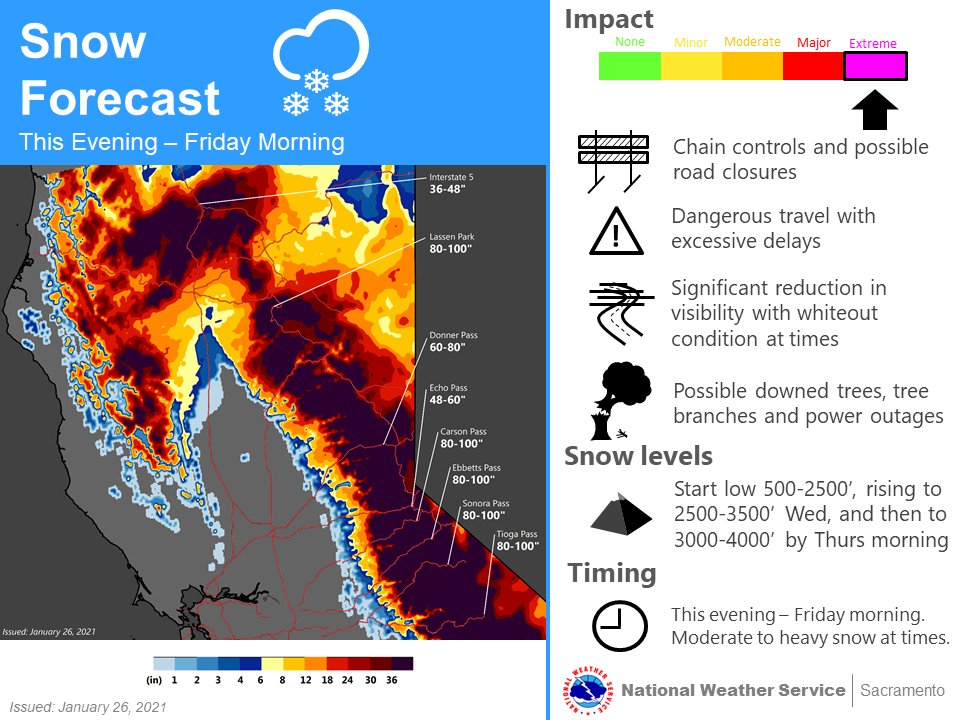
Obviously, this next system is something we will keep an eye on. Being so far out, this next system is just now arriving on the west coast, bringing triple-digit snow forecast numbers. Yes, the Sacramento NWS office is forecasting more than 100 inches of snow being possible today and tomorrow for some of their mountainous areas.
The low will continue to track across the Rockies through Friday. We will know a lot more about the track and timing of the system once it clears the Rockies and then begins its push to the west.
At this point, someone is going to get a lot of snow at the beginning of next week here in the Mid-Atlantic to the East Coast.
We will be watching to see if any of our areas will be part of what could potentially be a historic amount of snow for somewhere.
Stay up to date with the KDKA app, which you can download here.