Pittsburgh Weather: Another Cold Day With Possible Snow Showers Ahead
PITTSBURGH (KDKA) - Good morning, another frigidly cold morning with morning lows in the teens across the area.
When you factor in the wind, wind chill values are in single digits! You are going to want to bundle up.
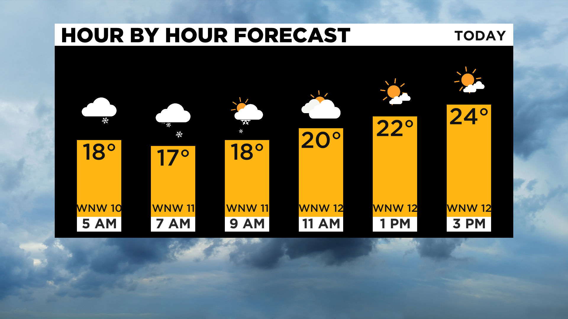
Just be aware that snow showers also continue to be possible this morning for Allegheny County and the surrounding donut counties. This snow chance should shift east as we head into the afternoon with partly cloudy afternoon skies. Afternoon highs should hit the mid-20s with noon temperatures near 20.
WEATHER LINKS:
Current Conditions | School Delays & Closings | Local Radar | Weather App | Photos
Looking ahead, there is still a lot we just do not know about Sunday to Tuesday's snow chances.
I am confident that the area will see accumulating snow during this time period. I am not confident about how much snow we will see. Part of the issue at this point is how much of what comes in will fall as snow and what will fall as rain.
Also, temperatures should pogo stick above and below freezing during this time, eating into accumulated snow.
So let's talk about my forecast for this period.
I am fairly confident we will see a very pronounced line where it comes from big (More than 5") snow totals and those that see a lot less.
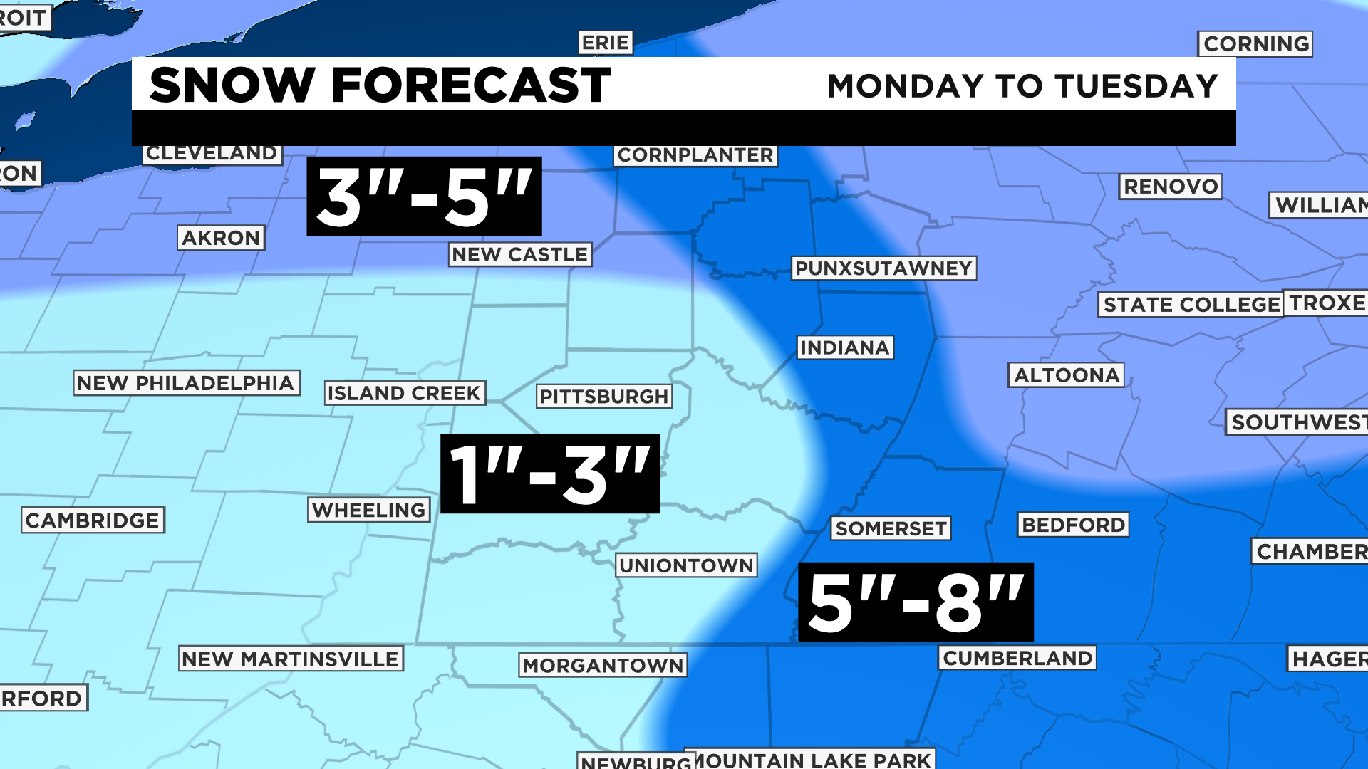
You will likely see within a spread of around 10 miles a snow total difference of 3" or more on average. This line is likely to set up along the Butler County-Armstrong County lines stretching through Westmoreland County.
It looks like model data is now in agreement when it comes to when it will begin to snow; Sunday at around 1:00 a.m.
We could see a decent amount of snow on the ground by the late morning hours of Sunday.
Then, temperatures warm, and rain takes over for snow before noon.
Light rain showers will then be expected through at least the morning hours of Monday before we see another change over to snow.
The timing of these rain to snow changes are still uncertain. Once the change over back to snow occurs we should see temperatures fall back to below 32 degrees, meaning we will have the best shot for accumulating snow at that time.
KDKA Meteorologist Mary Ours says the Euro model is going about 3-5 inches for Sunday through Monday night, while the GFS model is lower near 1-3 inches. Areas north and east along the ridges are expected to get more on the higher end as lake-enhanced snow showers take over for Monday.
As always, things not only can, but will change.
That is why it is so important to stick with KDKA through the weekend as our team of meteorologists will continue to update and improve the forecast.
In the meantime, make sure you're prepared for a winter storm expected to last several days.
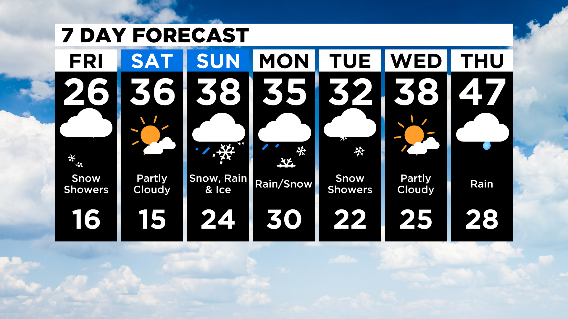
Some good news? The 40s return by next Thursday!
Stay up to date with the KDKA app, which you can download here.