Pittsburgh Weather: Rain And Snow Chances Return Thursday Night
PITTSBURGH (KDKA) - Good morning!
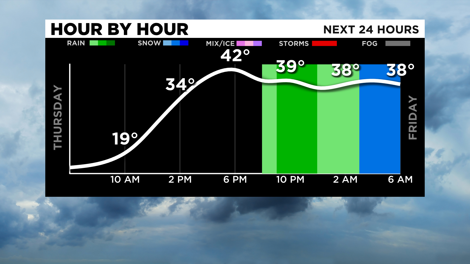
Most of today is going to be dry with rain and snow chances returning after 8:00 p.m. tonight.
WEATHER LINKS:
Current Conditions | School Delays & Closings | Local Radar | Weather App | Photos
The backside of the system looks to be the first of three mid-level low-pressure areas that could easily drop 2" of snow or more in just a couple of hours before pushing off to the east.
The slowest of these systems may very well be the Friday system with snow now forecast through the day on Friday and wrapping up with a burst of snow on Saturday as cold air rolls in once again.
The second round of snow arrives late Saturday evening and sticks around through sunrise with an additional 2" of snow possible.
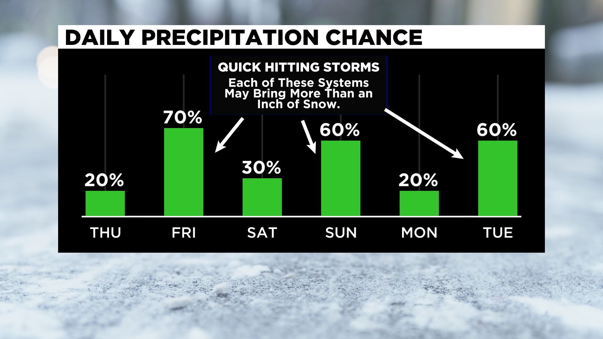
The third quick hitter arrives with the arrival of the coldest of air on Tuesday morning.
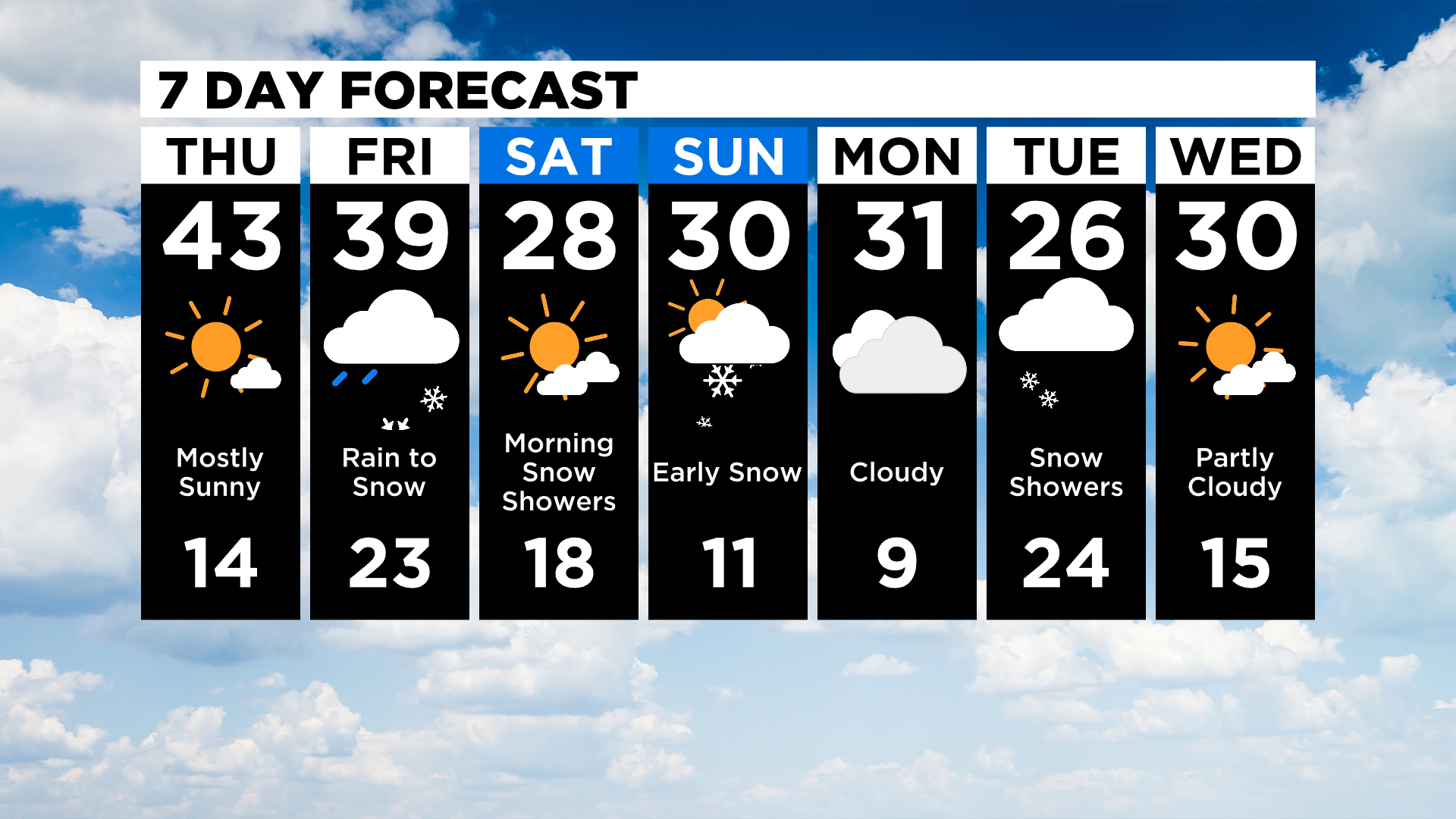
Now for some good news for most people, next week's impending brutally cold weather has for now been canceled.
Monday is now back to being the coldest day of next week and lows will be cold with most places likely falling into single digits.
The cold will not hold however with Tuesday lows up around 28 degrees. There is still a chance late next week for the cold to impact the area but up until then, there are some BIG changes to the extended forecast.
Stay up to date with the KDKA app, which you can download here.