Pittsburgh Weather: Weekend Begins Cloudy, Snow Chances Possible This Weekend
PITTSBURGH (KDKA) - Good morning!
The best chance for snow and rain has already passed us by for the day. We have also seen today's high temperature already coming in at 38 degrees.
WEATHER LINKS:
Current Conditions | School Delays & Closings | Local Radar | Weather App | Photos
The rest of the day will be cloudy with scattered snow showers possible as we cool. Morning temperatures will be near 30 with afternoon highs being in the mid to low 30s.
Winds will be out of the west-southwest at 10-20 mph.
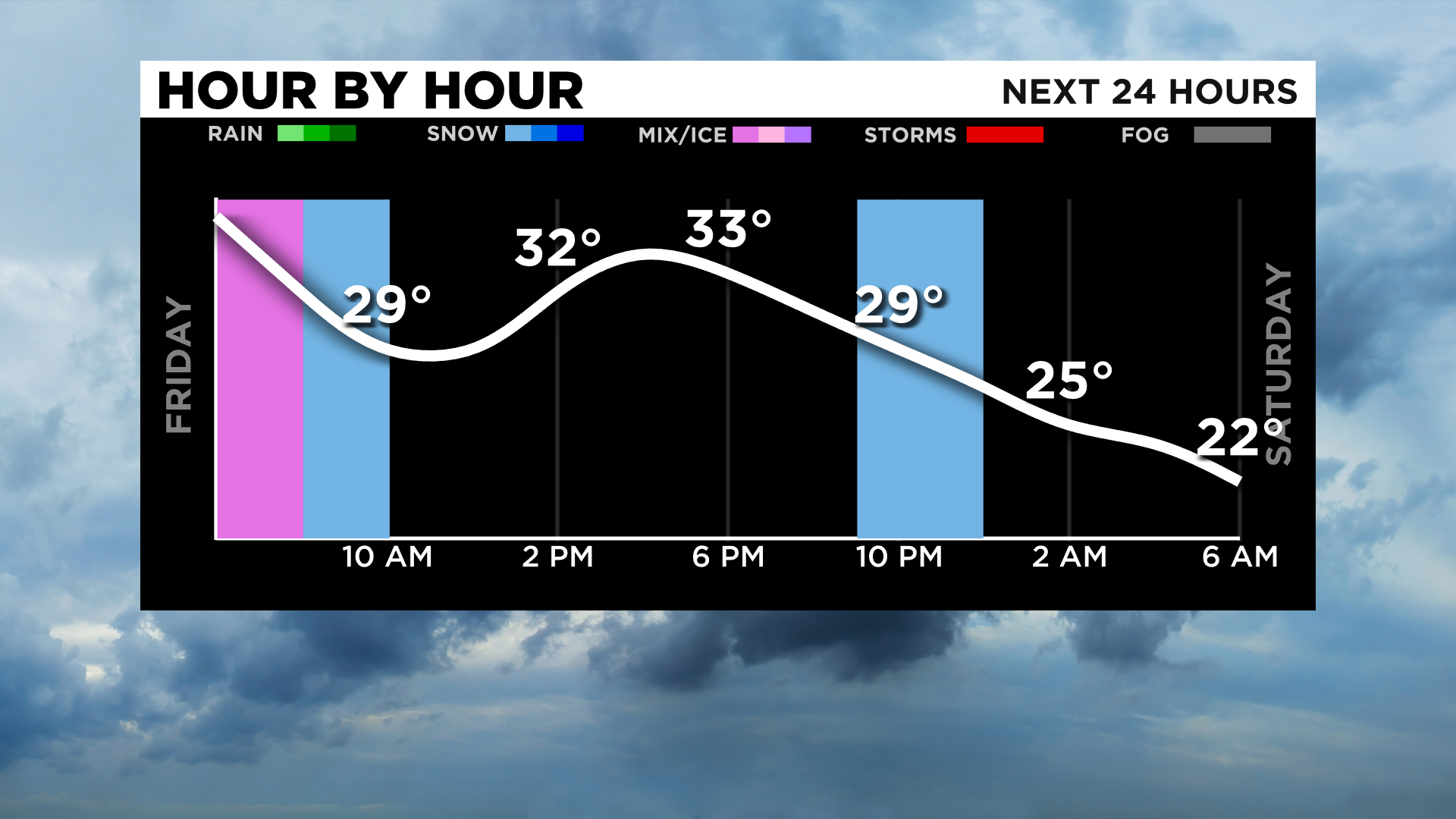
Looking ahead, there will be several chances for snow over the next couple of days.
One of those quick chances for snow comes tonight with maybe a quick quarter-inch of snow possible.
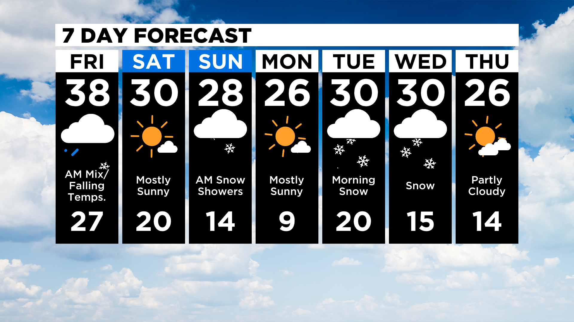
The second chance for snow comes in late Saturday night into Sunday.
The interesting thing about this round of snow is there is still a lot of disagreement with model data on what could be a major winter storm. For us, it looks like the fast-moving system may drop up to 2" of snow region-wide with obvious spots seeing significantly more.
Generally, you'd expect better agreement with such a large system, but there is plenty of data that shows little to no snow coming from the Sunday system.
While we are still seeing data pointing to next week being the coldest of the season so far, temperatures are still remaining above the brutally cold weather I was forecasting earlier this week.
Monday still is looking cold with morning lows in the single digits.
Also monitoring Friday into next weekend where data is now showing the brutally cold weather arriving.
Stay up to date with the KDKA app, which you can download here.