Winter Weather: One-Two Punch Storm System To Bring Heavy Snowfall, Ice Accumulation To Pittsburgh Area
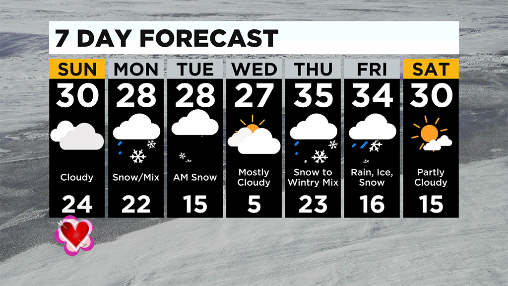
PITTSBURGH (KDKA) -- Dry air moves in today, so it'll be a quiet, cloudy day before some big snow totals for the start of the week arrive.
The several waves of snow we are seeing arrive overnight and will last through Tuesday morning!
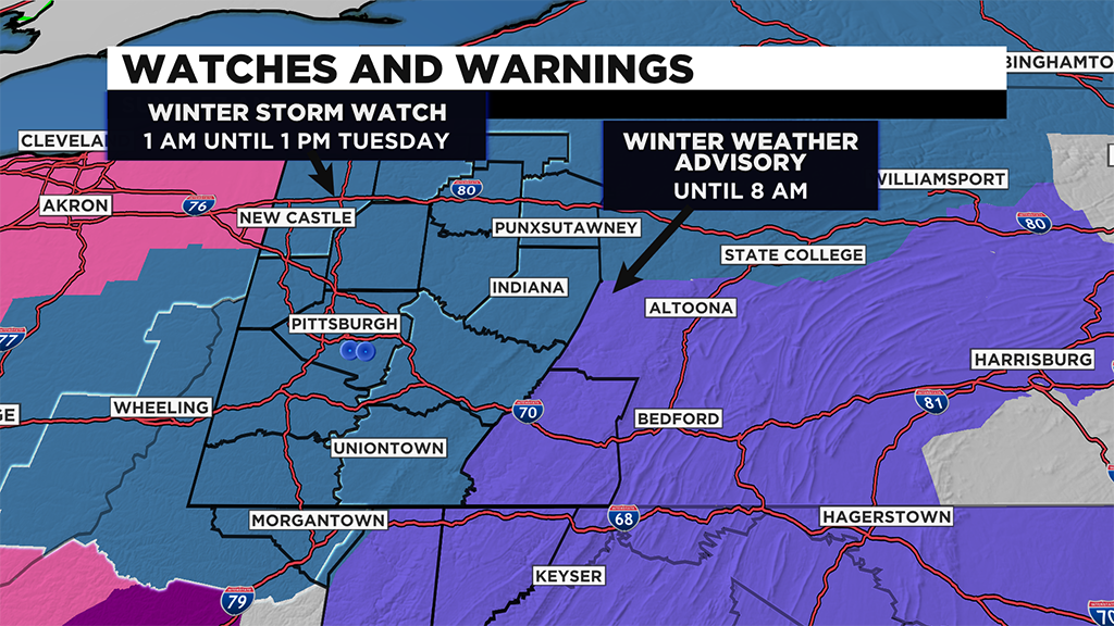
Winter Storm Watches are in effect starting at 1:00 a.m. Monday morning and will be in effect until 1:00 p.m. Tuesday.
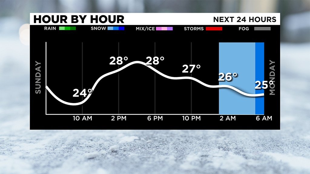
Snow arrives late tonight and will be heavy through the morning commute leaving many with 2-3" by the afternoon.
There will be a few breaks in the snow but not long breaks.
The second round of snow moves in during the late afternoon and evening and lasts through early Thursday which will bring an additional 4-6" for many.
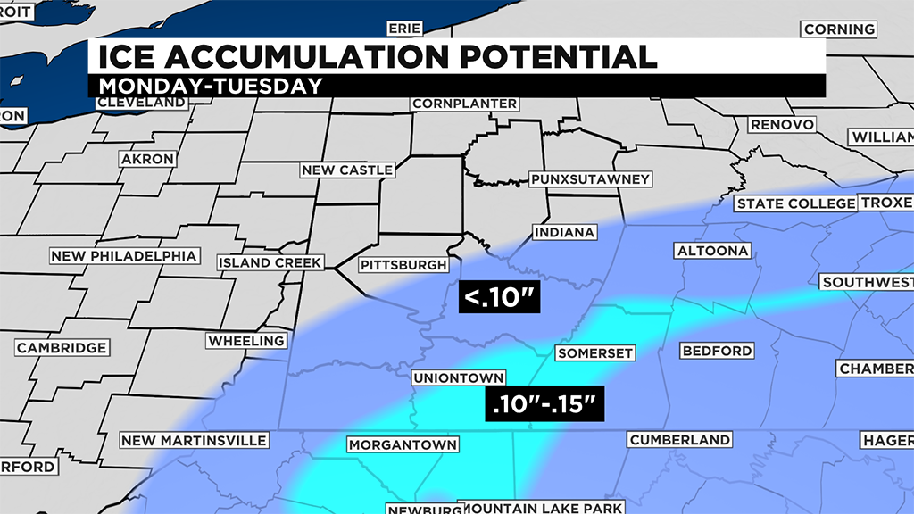
There is still a big cut-off with totals for areas south of I-70 because of a mix and even freezing rain.
Totals for Pittsburgh are near 6-8" while areas north is in the 8-12" range.
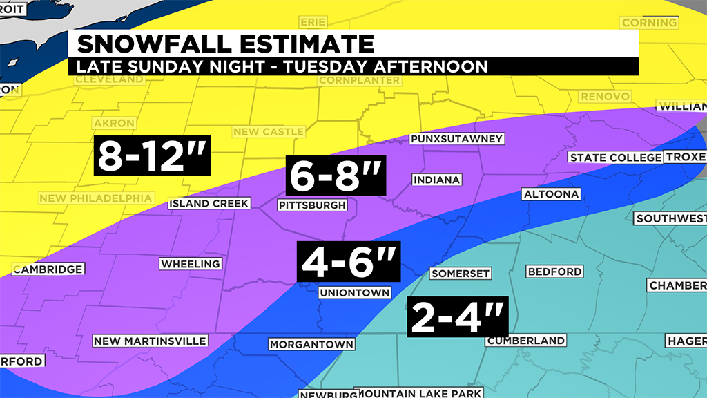
There is still a question how far north the warm air gets but that's going to pose an ice threat of 0.1" to .15" of ice accumulation for areas south and east along the ridges for early Tuesday morning. It could take down totals significantly.
Another big thing is a refreeze Wednesday morning as lows look to drop near and in the single digits before we see the warmest day in a while on Thursday with highs in the mid to upper 30s but another wintry mix tracks through the region for the end of the week.
WEATHER LINKS:
Current Conditions | School Delays & Closings | Local Radar | Weather App | Photos
Stay up to date with the KDKA app, which you can download here.