Hey Ray! What Causes Lake Effect Snow To Be Created
PITTSBURGH (KDKA) -- We have talked about how each snowfall is different. How snow is created is different, too.
There are bigger sized weather systems that impact a large area. We call those synoptic systems. Then there are small-scale weather systems that impact localized areas.
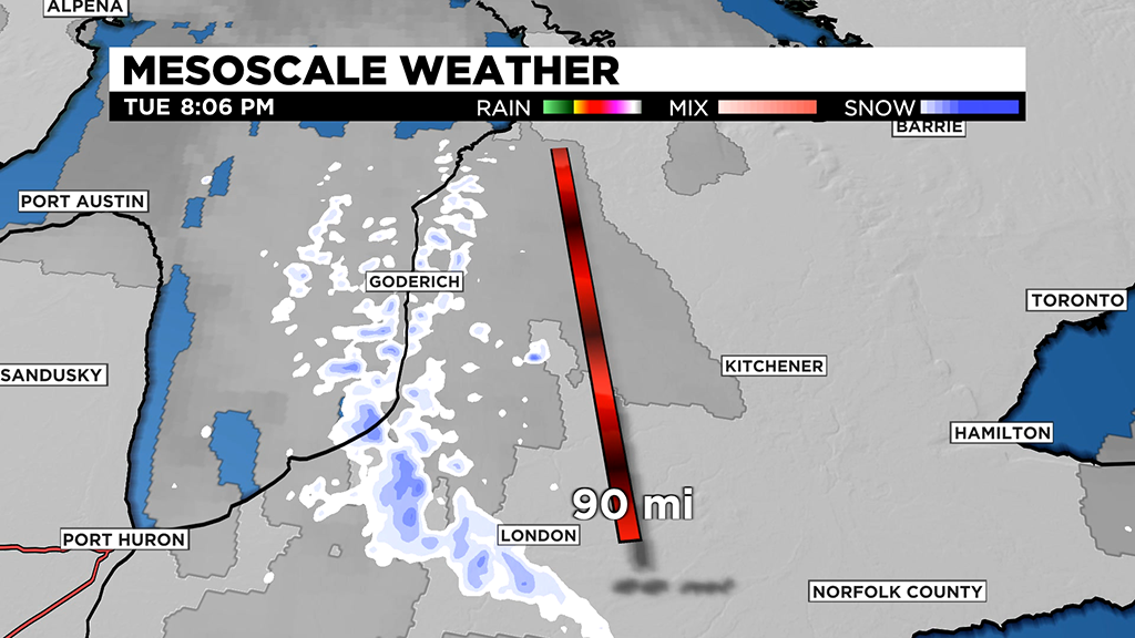
A type of mesoscale weather is our topic today: Lake effect snow. It is probably the most known type of small-scale weather in our region because it can have such a big impact, and the first ingredient you need for lake effect snow is a lake.
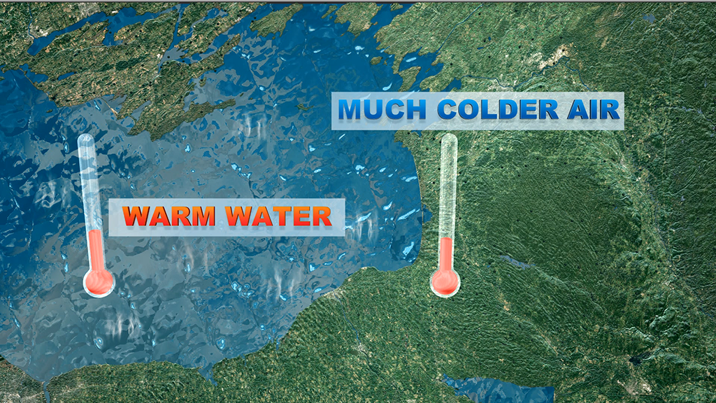
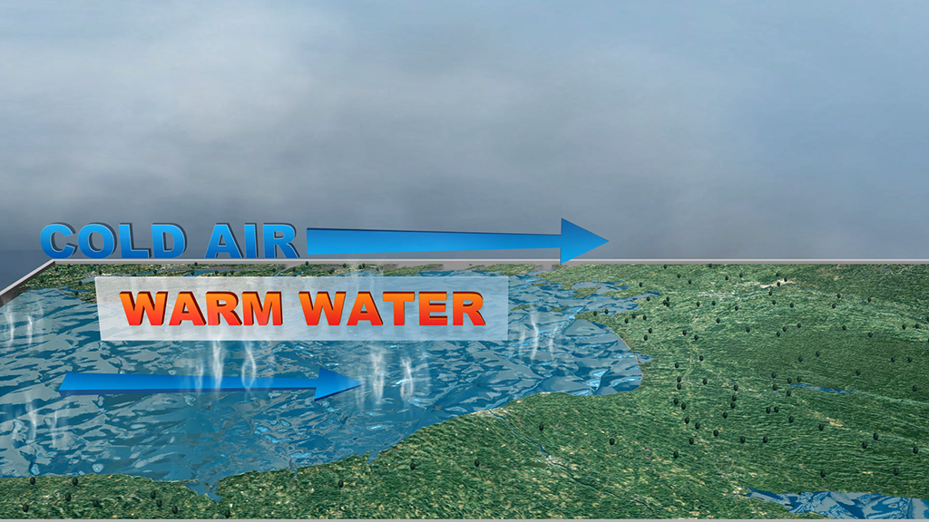
More specifically, a lake that is warmer than the air above it to be more precise. When you lose 55 degrees between the water's surface and a mile up in the atmosphere, you start seeing the potential for significant lake effect snow.
This set up causes the water to evaporate in the cold, air and the heat causes the air to rise. That is what is known as "convection", the warmer parts move up and the colder parts move down.
Wind is the next big factor. You need wind to push that moisture toward land. Wind direction and distance is very important. We call a wind that travels a long distance a "fetch". When that fetch, or wind, travels a long distance over lake water, it picks up more moisture. As that moisture cools, it condenses then turns to snow.
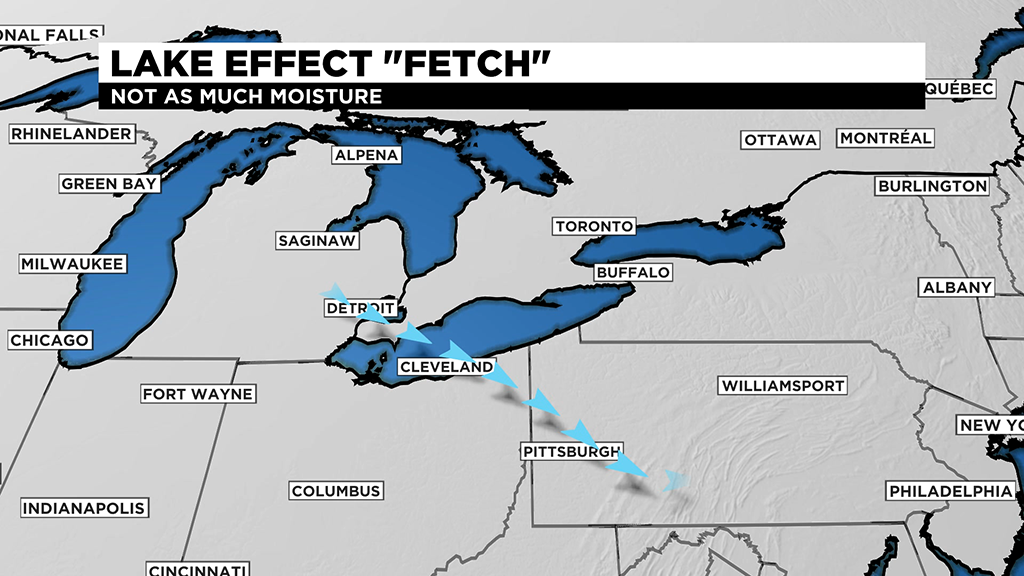
Most people in our area look to Lake Erie for our lake effect snow, but when the other lakes are involved, especially Lake Huron, we can get some pretty good lake effect snow down here.
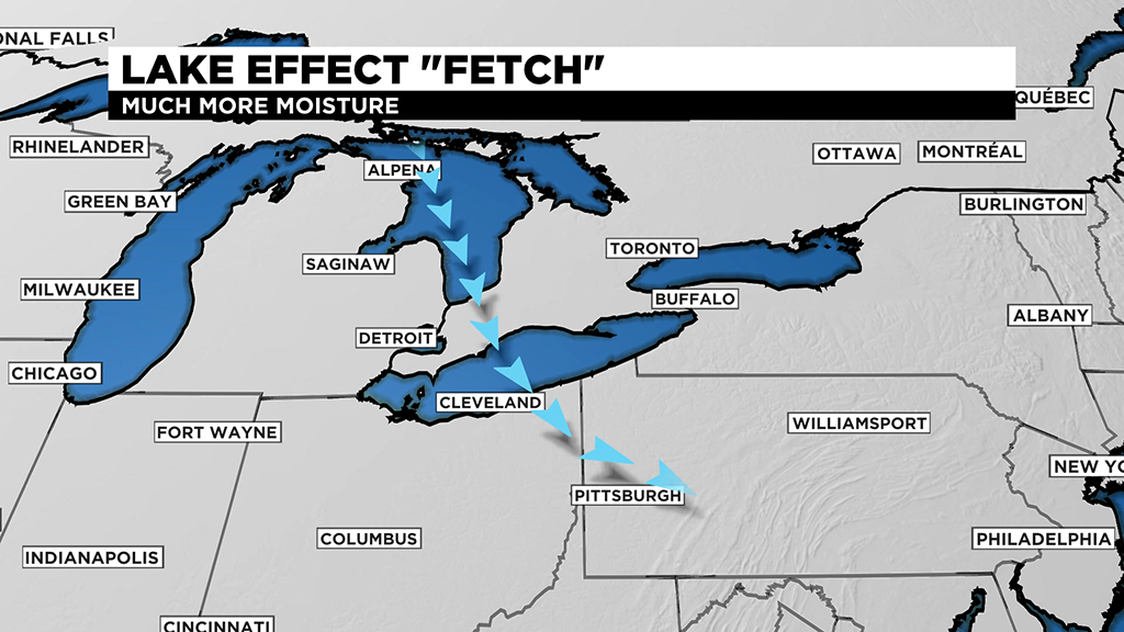
The other big lake effect ingredient is orographic lift. Orographic lift is caused by land creating friction and forcing the air upward. When wind blows across the lakes, there is not much in its way, allowing it to move rather freely. Once the wind starts to encounter land, it slows down. When that happens, our convection, or uplift is enhanced. Think of it like this. The moisture starts to pile up because of friction, and that forces the air upward even more. Condensing even more and making more snow.
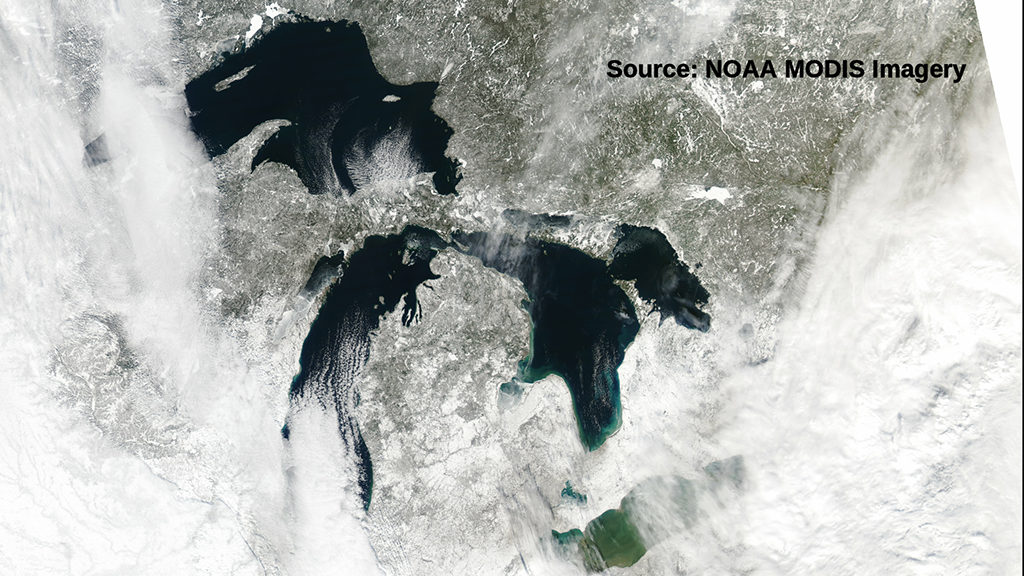
The greatest potential for lake effect snow occurs when the Great Lakes are ice free. Once they become covered in ice, lake effect snow becomes less likely.
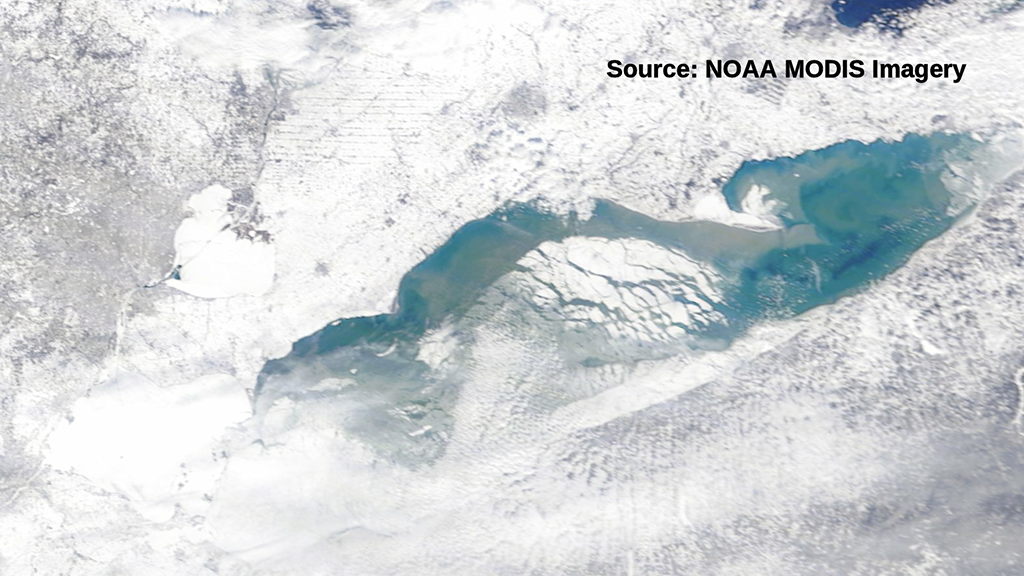
The ice acts like putting a lid on a container, cutting off the ingredients to make snow.
WEATHER LINKS:
Current Conditions | School Delays & Closings | Local Radar | Weather App | Photos
Stay up to date with the KDKA app, which you can download here.