Pittsburgh Weather: More Sunshine Today Following A Cold Morning
By: Ron Smiley
PITTSBURGH (KDKA) - Hello, just a couple of housekeeping items to talk about from yesterday's wild weather day.
The final snow total for Pittsburgh (falling) will stand at 1.8".
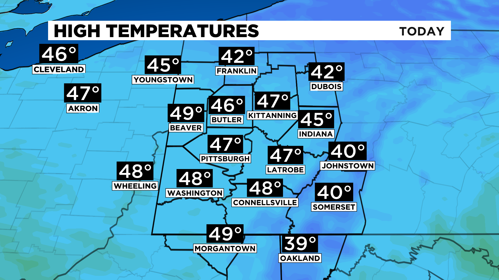
We also set a record but not due to the amount of snow. The record that fell comes from the fact it was the coldest high temperature on record for the day.
WEATHER LINKS:
Current Conditions | School Delays & Closings | Local Radar | Weather App | Photos
We only hit 40 degrees for our high. The old record was a high of just 41 degrees set all the way back in 1875.
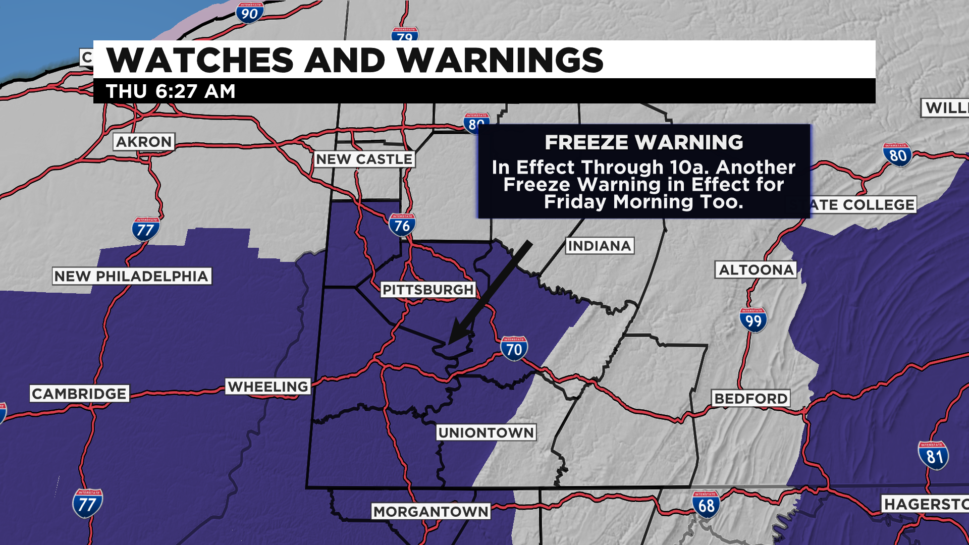
There's still a couple of isolated lake effect snow showers impacting the snow belt this morning. The cold air is still obviously in place too with Freeze Warnings in place locally through 10:00 a.m.
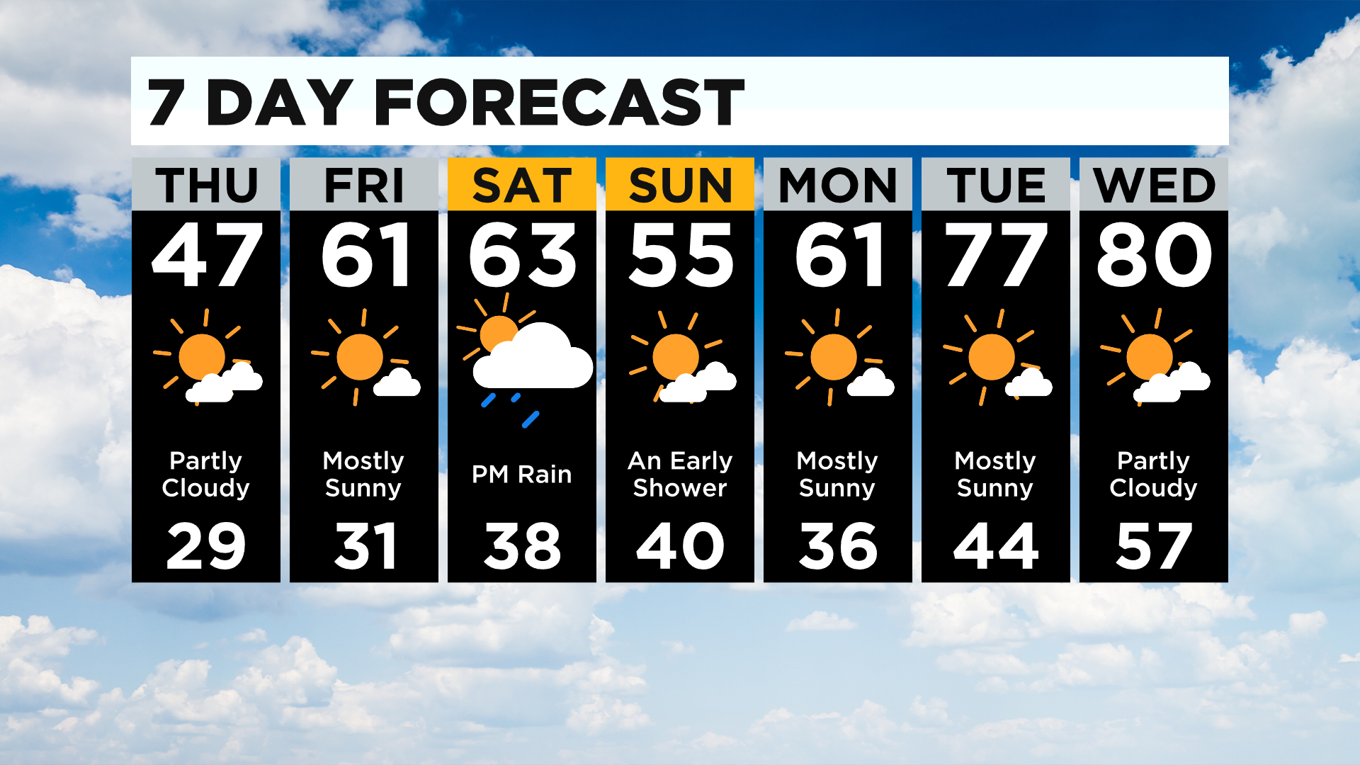
I have the snow coming to an end by 8:00 a.m., and sunny skies for the rest of the morning.
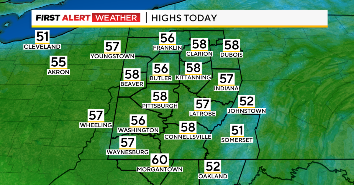
Highs today should be in the mid to upper 40s. Winds will be out of the west at around 10-20mph this afternoon, meaning that it is going to feel chilly all day long.
Yes, you are certainly going to want to bundle up as you head out the door.
While most of today will be dry, snow fell overnight along the snow belt. This is important because if there are untreated roads out that way, slick spots will be possible on roads through at least 10:00 a.m.
Thankfully it doesn't seem like we've had too many issues during the morning. There is also the smallest of drizzle and flurry chances around midnight as a warm front slides through the area.
Even with the front through, there is a freeze warning through 8:00 a.m. on Friday.
Our next chance for rain comes in on Saturday afternoon. This will be due to a cold front that will slide through and it will mean cooler weather for Sunday.
At this point it looks like highs on Saturday should still hit the mid to low 60s, but a lot of data really pulled down highs for Saturday. Rain chances should start to go up after 3:00 p.m.
The heaviest of the rain falls from 8p to midnight on Saturday.
Rain should wrap up before sunrise on Sunday morning.
From there we see temperatures ticking up until we hit 80 degrees on Wednesday for our high.
Stay up to date with the KDKA app, which you can download here.