Pittsburgh Weather: Cool Conditions Continue
PITTSBURGH (KDKA) -- The weather pattern remains uncertain today as an upper low continues to sink to the south.
The upper low is located right on top of Ottawa, Canada.
The low will move into northern parts of New York by the end of the day, eventually being absorbed into an active jet.
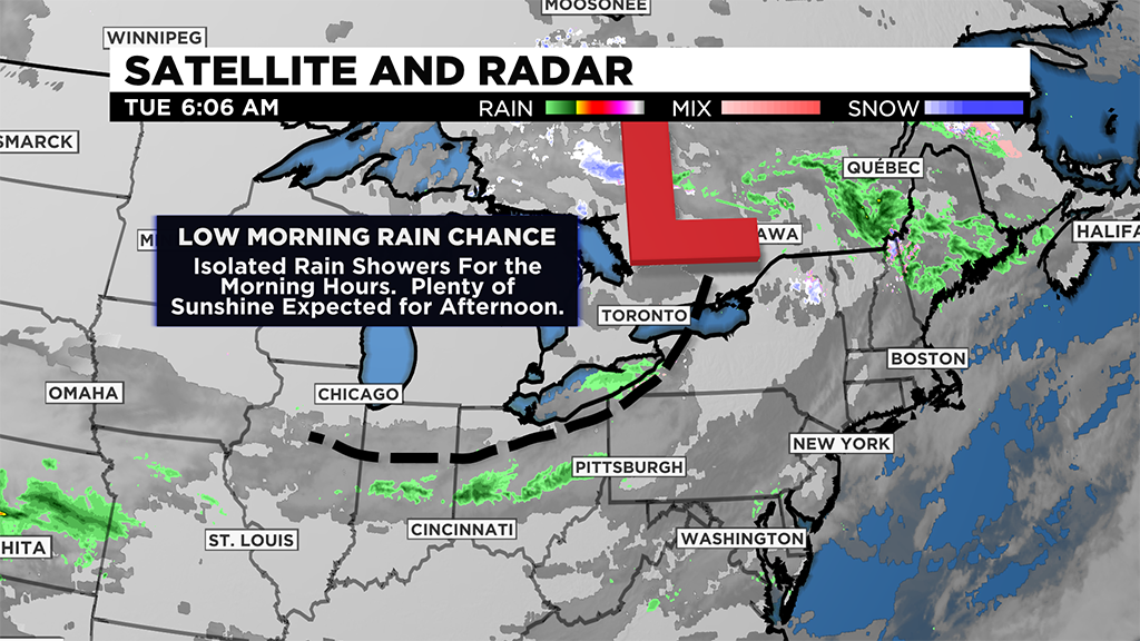
The upper low will continue to pull cold arctic air down from the north, so expect another cold day today with highs just in the mid-50's.
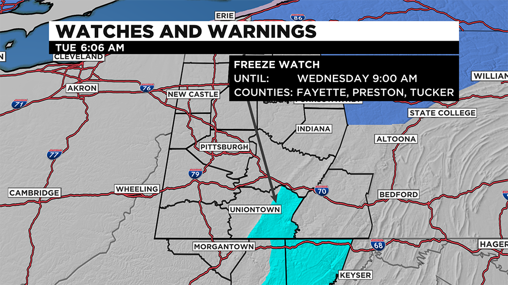
The biggest concern in the near term is that overnight lows will likely drop to the mid-30s on Wednesday.
With clear skies and low winds, this could potentially mean frost development.
Frost advisories may be issued across our area.
We already have a freeze watch issued for parts of Fayette County due to expected morning lows.
Either way it goes, today may be a good day to walk in any potted plants from outside and to cover any plants already in the ground.
Looking at the rest of the work week, after the chilly Wednesday start to the day, things will be warmer for the rest of the week.
Highs return to the 60's on Wednesday afternoon.
Highs will be near 70 for the weekend.
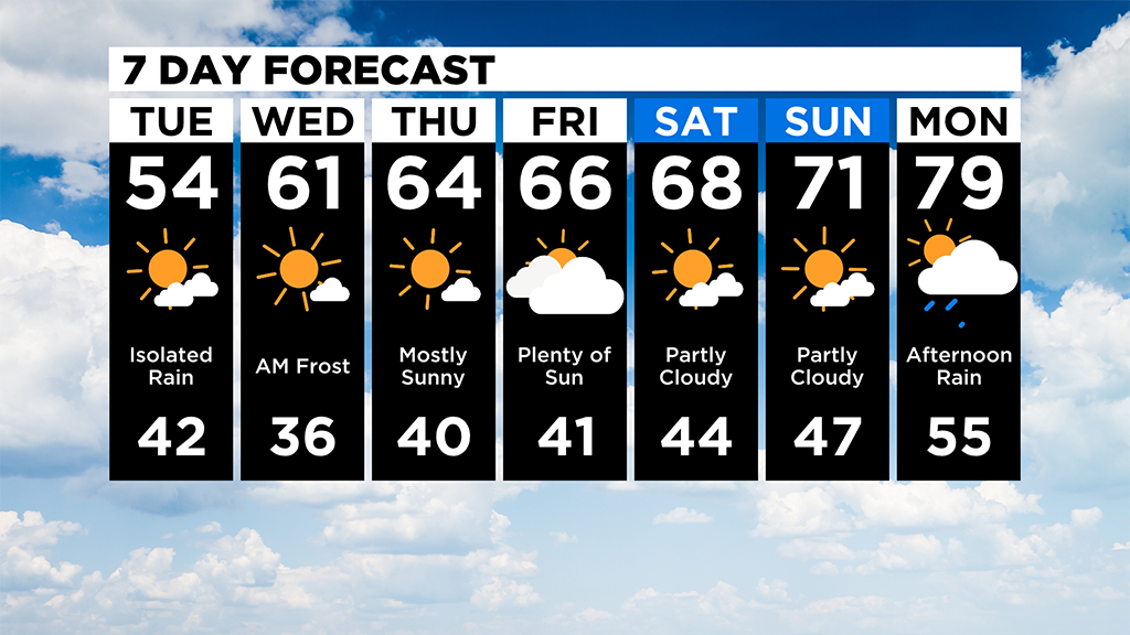
I have Monday's high near 80 before our next good chance for rain arrives.
WEATHER LINKS:
Current Conditions | School Delays & Closings | Local Radar | Weather App | Photos
Stay up to date with the KDKA app, which you can download here.