Pittsburgh Weather: Severe Weather Chances Return To The Area Thursday
PITTSBURGH (KDKA) - Good morning!
While the set-up is a little different today the chance for severe weather will return to our area.
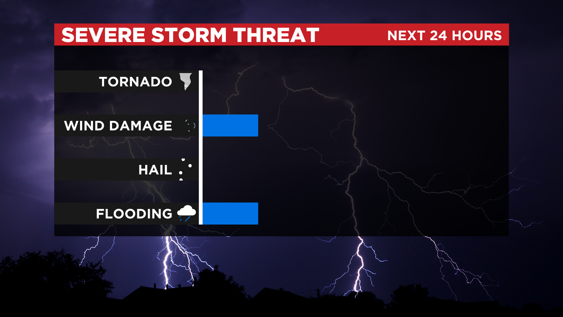
At this point, strong wind and downpours will again be possible with our severe weather chance confined to the passage of a cool front after 5:00 p.m.
WEATHER LINKS:
Current Conditions | School Delays & Closings | Local Radar | Weather App | Photos
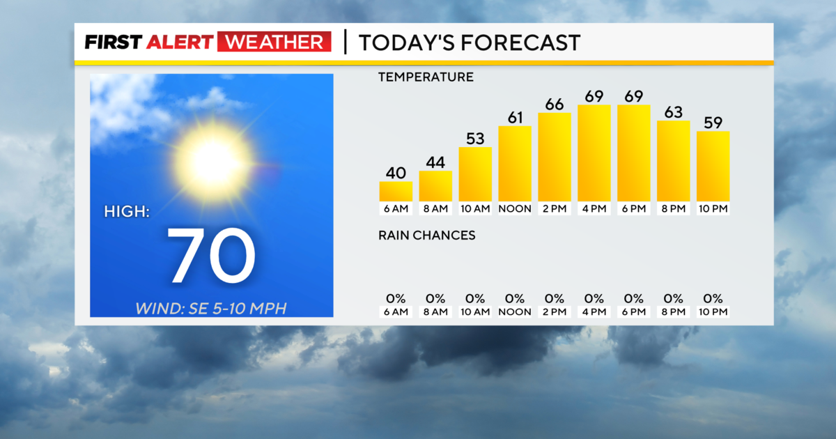
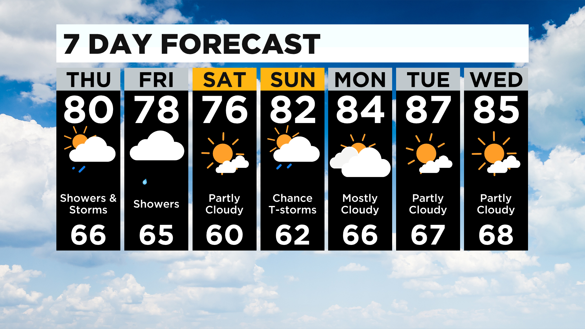
Rain showers will be possible leading up to then with highs likely just around 80 degrees due to rain and clouds. The air mass in place is still moisture-rich with dew points still near 70 degrees.
Unlike yesterday we won't have the chance to see potential energy values (cape of 1000 or less) rising to where they were yesterday. That is due to the expected rain showers that will be around off and on through the day.
For comparison, today's highs are only expected to be around 80 degrees.
Yesterday's highs hit 88 degrees.
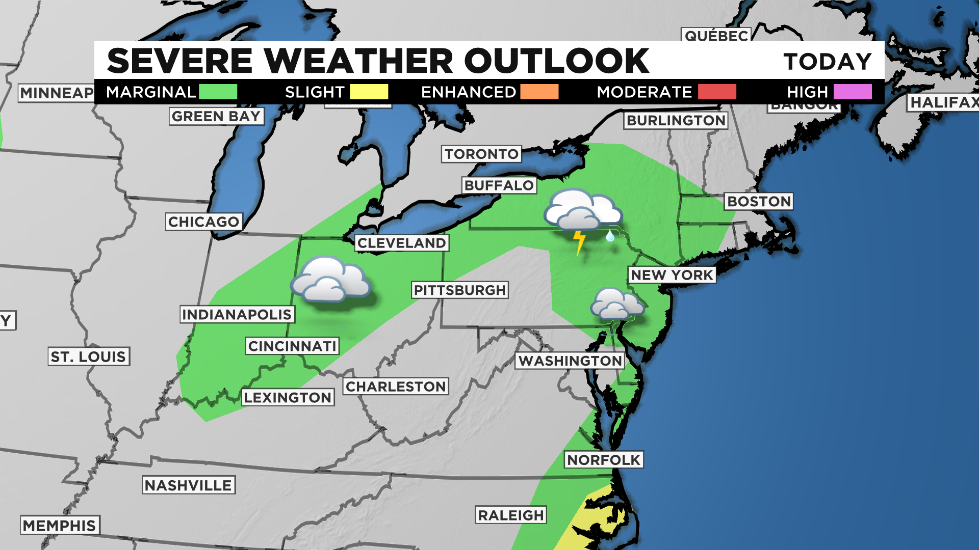
This, along with dew points slightly down from yesterday (along with total moisture) should mean the threat of flash flooding will be lower today. Our severe weather chance overall is lower as well with places just along I-80 being painted into the area for a marginal risk of severe weather.
Places in Ohio are also included under the marginal risk due to being just ahead of the backside of an upper low that will slide by over the next 24 hours. The timing of the system puts the most lift in our area overnight tonight.
Due to this, best dynamics for severe weather passing by while the sun is down, our chances for strong storms remain low. Strong winds would be the likely cause of any severe weather locally, if we see any.
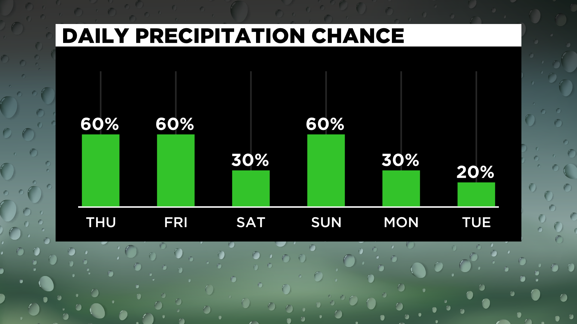
While rain chances stick around for another day on Friday, it should be all rain showers and few if any storms. Highs on Friday will be down into the upper 70s with the coolest air with this system passing by on Saturday.
Saturday highs will be in the mid-70s.
Warmer air returns on Sunday with a chance for weak storms as moisture and heat return from the southwest.
Stay up to date with the KDKA app, which you can download here.