Pittsburgh Weather: Hot, Humid Conditions, Dry Stretch Of Weather Continues
PITTSBURGH (KDKA) -- We need some rain. No, isolated downpours don't really count right now as their coverage area isn't enough to really have much impact region wide.
When I say we need some rain, I am talking about a couple of 1/2" region wide rains with us seeing at least a little rain each day over the period of a couple of days. It looks like we have a real shot at seeing that type of rain happening for the back half of this week.
Since July 18th, Pittsburgh's airport has reported 'just' 0.5" of rain. This is the driest stretch at the airport in more than 90 years.
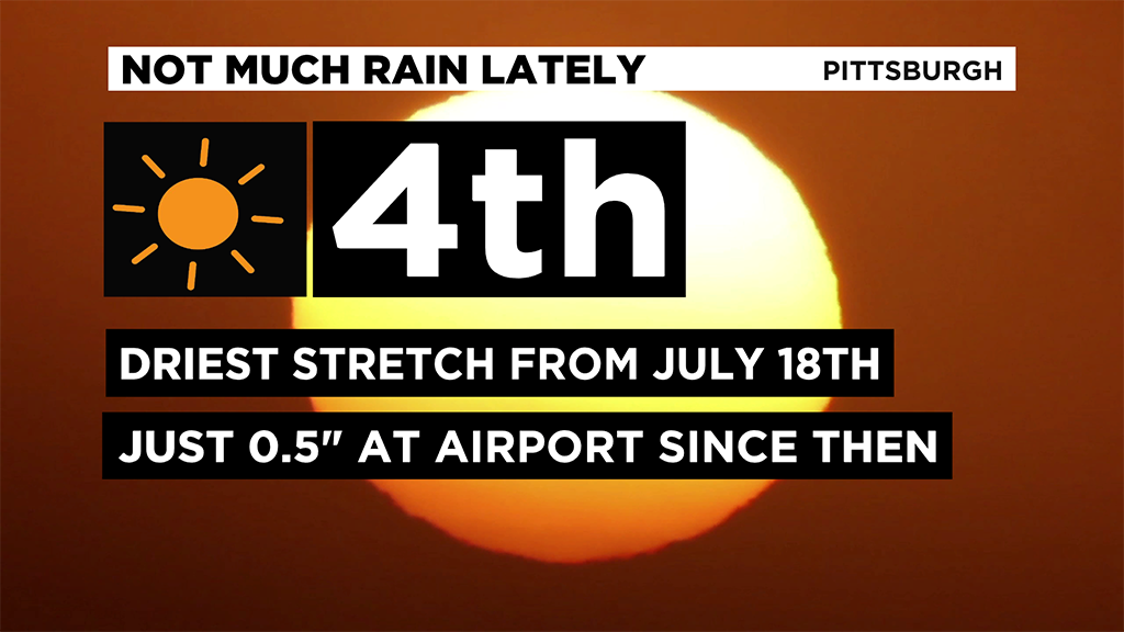
It's the fourth driest stretch during this time period on record.
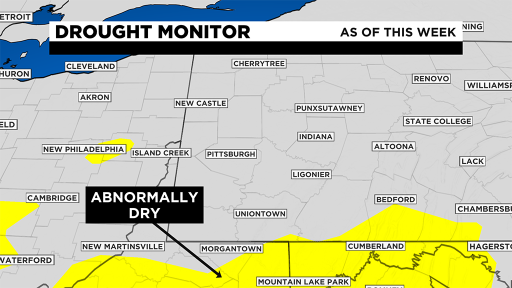
We are starting to see 'abnormally dry' conditions creep back into our region according to the US Drought Monitor's weekly summary. The next summary is issued on Thursday but the data cut-off is on Tuesday morning.
This means we are more than likely going to see parts of our area listed as 'abnormally dry' in this week's summary.
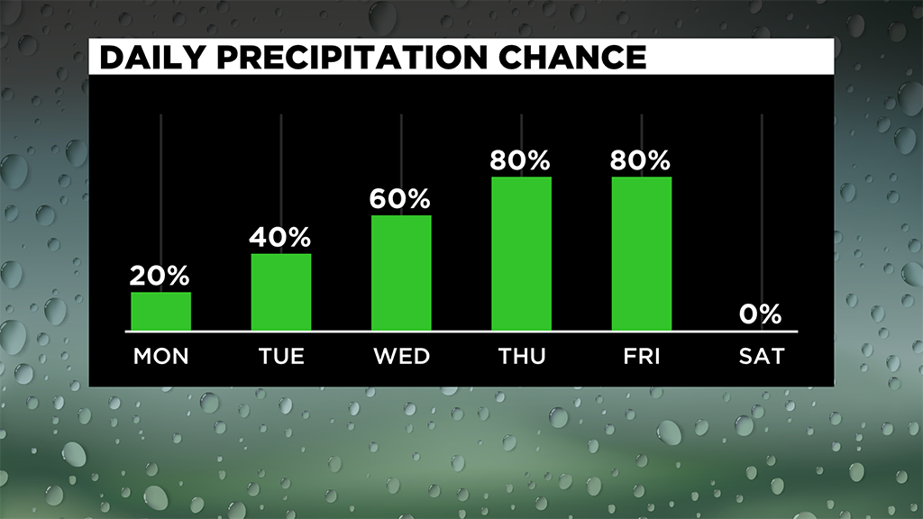
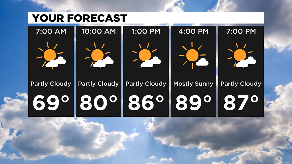
So let's talk about rain chances for the week. For today, your rain chance is similar to yesterday's rain chance.
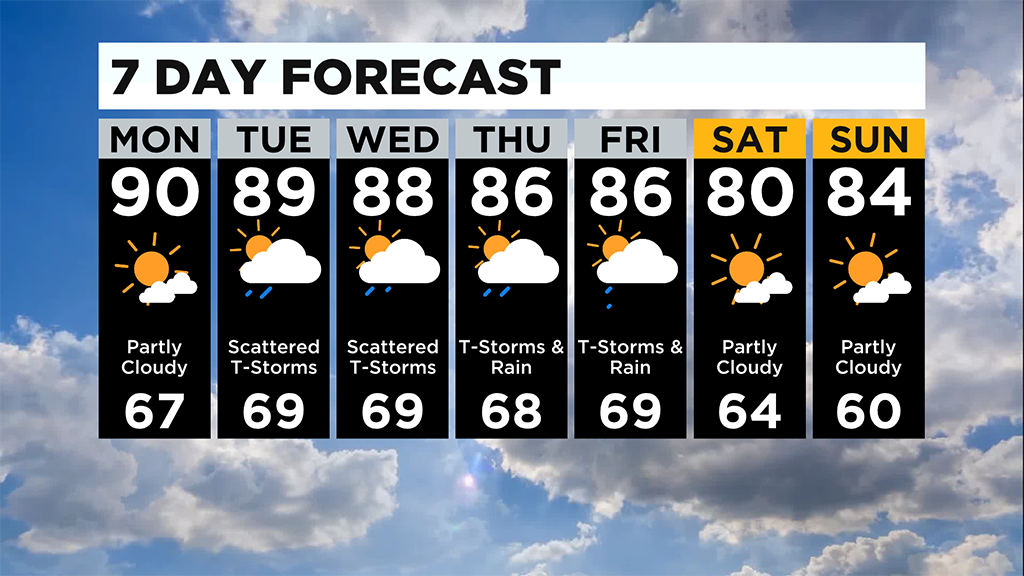
I have the area listed under an isolated chance. Rain chances increase to scattered on Tuesday and Wednesday with rain possible throughout the day on both days.
Rain will not be continuous and will be mostly off with some brief rounds of rain.
We are listed as having a marginal risk of severe weather with strong wind speeds being the main concern.
We are also already included under a marginal risk of severe weather for Wednesday too with wind speeds again being the biggest concern.
Rain chances continue to rise heading into the back half of the work week with widespread rain and storms expected for both Thursday and Friday.
At this point it does not look like we will see severe weather chances spiking on those days but things could change depending on how things break down.
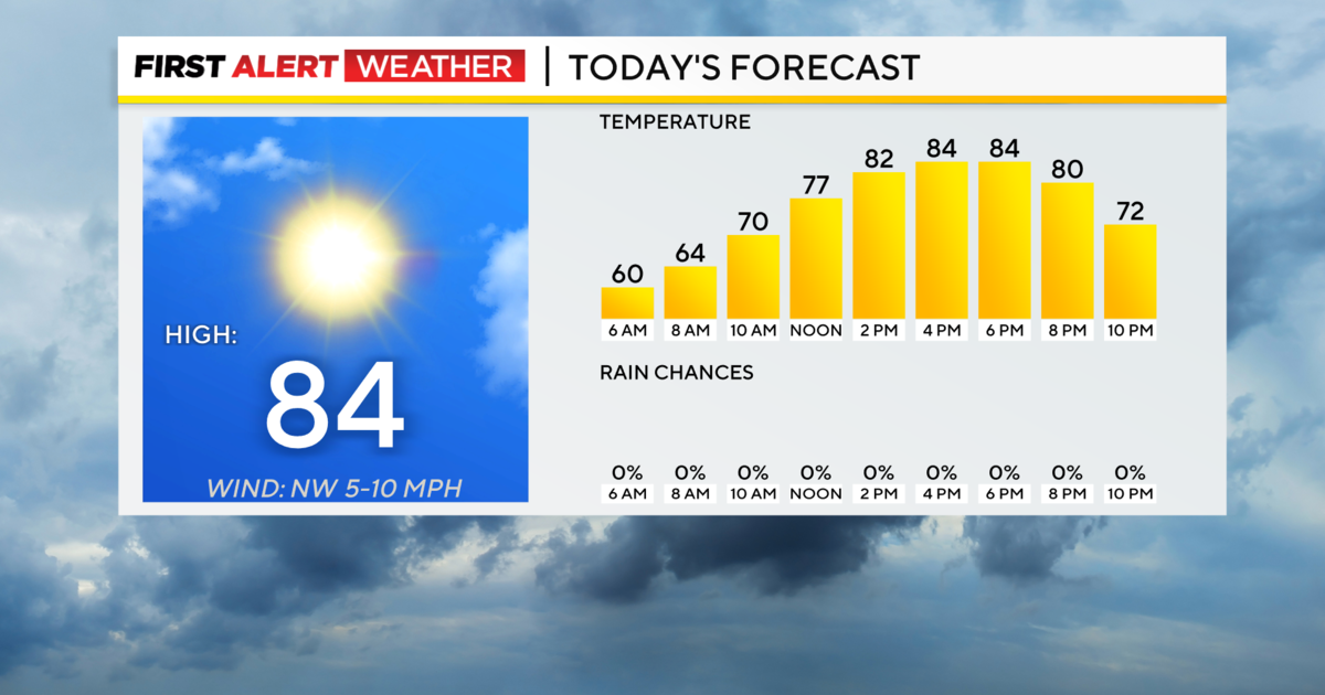
I am forecasting highs today to hit 90 degrees.
If we hit the 90 degree mark it would be the third of the year and the first since late June.
Across the state, high school football teams are getting together for the first day. It's start of a five-day heat acclimation period before fall sports officially kick off. The whole point is for the football players to get to work without a full uniform on. But imagine doing it in this heat.
WATCH: KDKA's Nicole Ford Reports.
Rain chances will likely keep us out of the 90's on Tuesday and Wednesday with a very warm air mass in place through Friday.
WEATHER LINKS:
Current Conditions | School Delays & Closings | Local Radar | Weather App | Photos
Stay up to date with the KDKA app, which you can download here.