Pittsburgh Weather: Heavy Rains From Tropical Storm Fred Move In On Wednesday
PITTSBURGH (KDKA) - Hello, today's the big rain day for the week for us in western Pennsylvania.
Moisture moving in from the south that was Tropical Storm Fred earlier this week will move through today. Rain totals of at least an inch should be expected wherever you are here in western Pennsylvania.
WEATHER LINKS:
Current Conditions | School Delays & Closings | Local Radar | Weather App | Photos
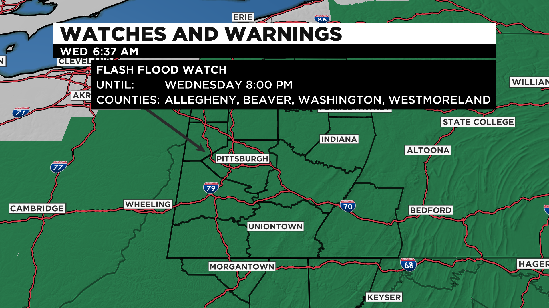
There is a flash flood watch that has been issued through 8:00 p.m. tonight, but if you're in Pittsburgh most of the rain will have fallen by 5:00 p.m.
Meanwhile, a Flood Advisory is in place for Allegheny, Beaver, Washington, and Westmoreland counties until 1:30 p.m.
The difference between the two is a Flood Watch you want to be prepared because the conditions are favorable for flooding and it's possible. A Flood Advisory for those counties above means be aware of flooding but not looking to be bad enough in these areas to issue a warning. Still need to take caution!
If you're wondering, the record daily rain total for today is 2.42" set in 1888.
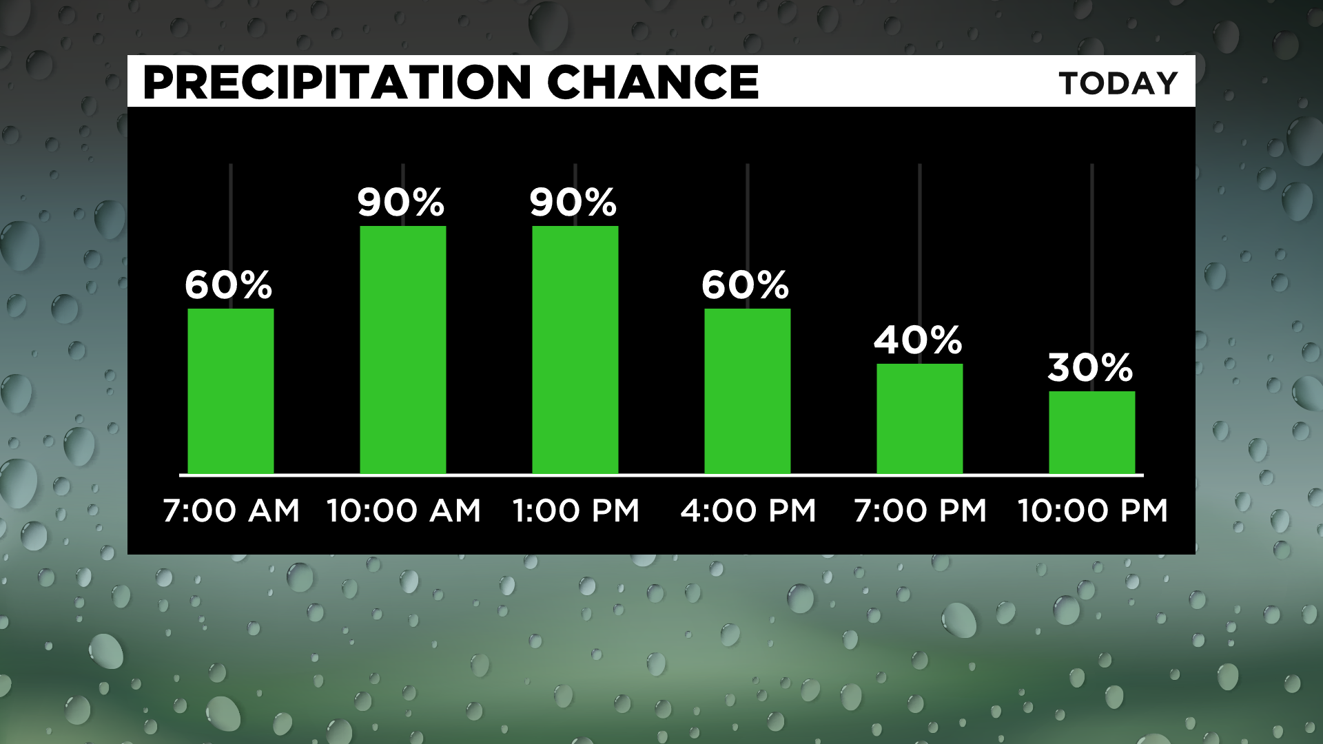
Timing out today's rain, if you're in Pittsburgh, the heaviest of the rain for the day should be expected between 8:00 a.m. to 1:00 p.m.
Rain rates in a couple of the bands that roll through could surpass 2" per hour.
While these high rates won't last very long it will be enough to cause flash flooding concerns for our area.
The center of rotation of this system will move through our area late morning to the early afternoon hours and that is when the flood risk will peak.
The flooding risk will be highest for places just north of the center of rotation. At this point, my confidence is high that the highest flood risk will occur somewhere between Allegheny County and the I-70 corridor.
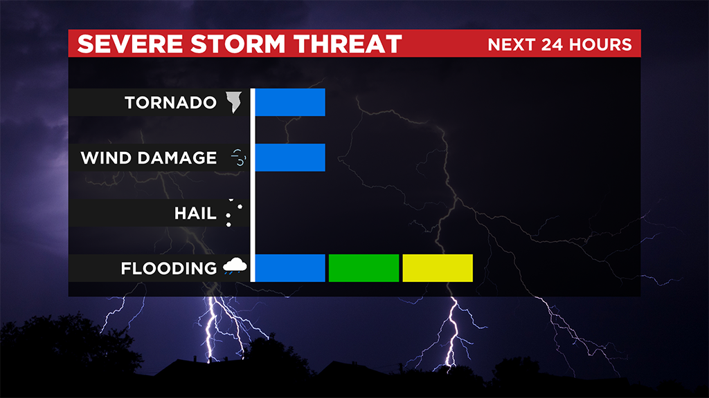
I can't narrow it down more than that right now but my biggest concern right now is with the heaviest rain band of 2" of rain per hour stops moving to the north and remains over one area for an hour or two.
This would allow a place to potentially see more than 2.5" of rain or more. We've already seen 3.16" of rain this month, one of the wettest starts to the month on record for Pittsburgh. Heavy rain in already soggy areas could obviously pose a large risk of severe weather.
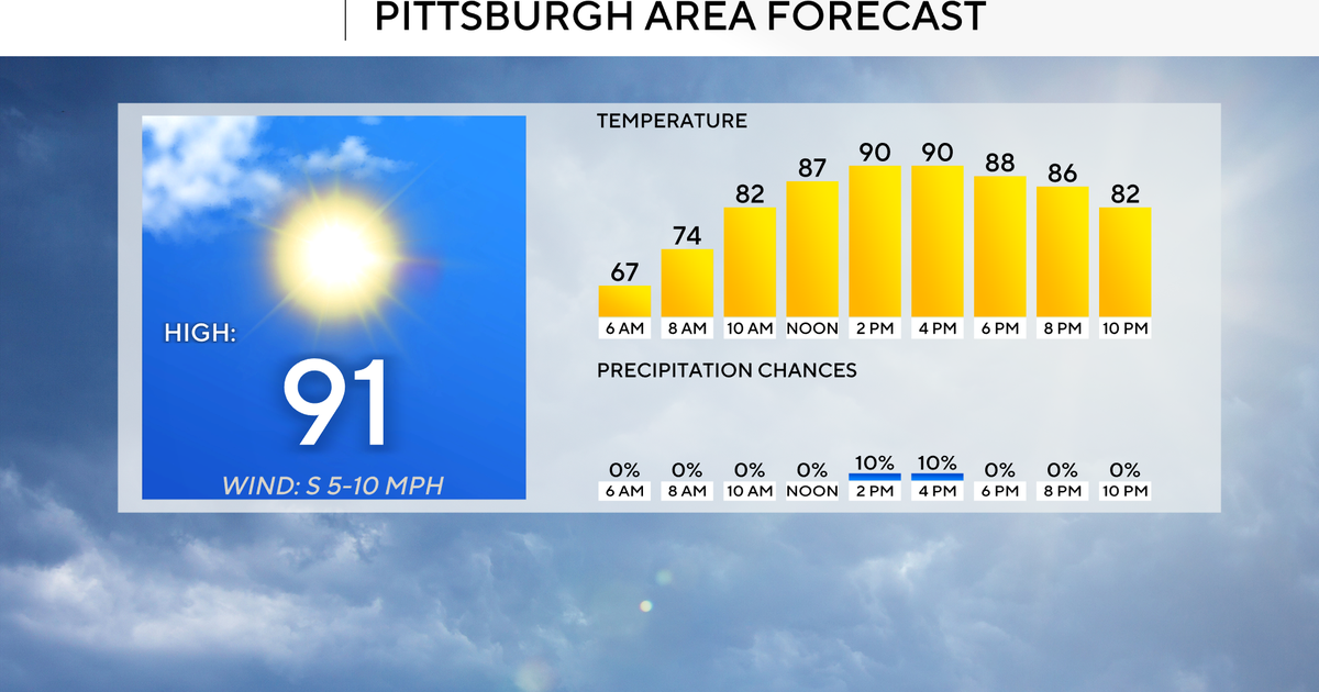
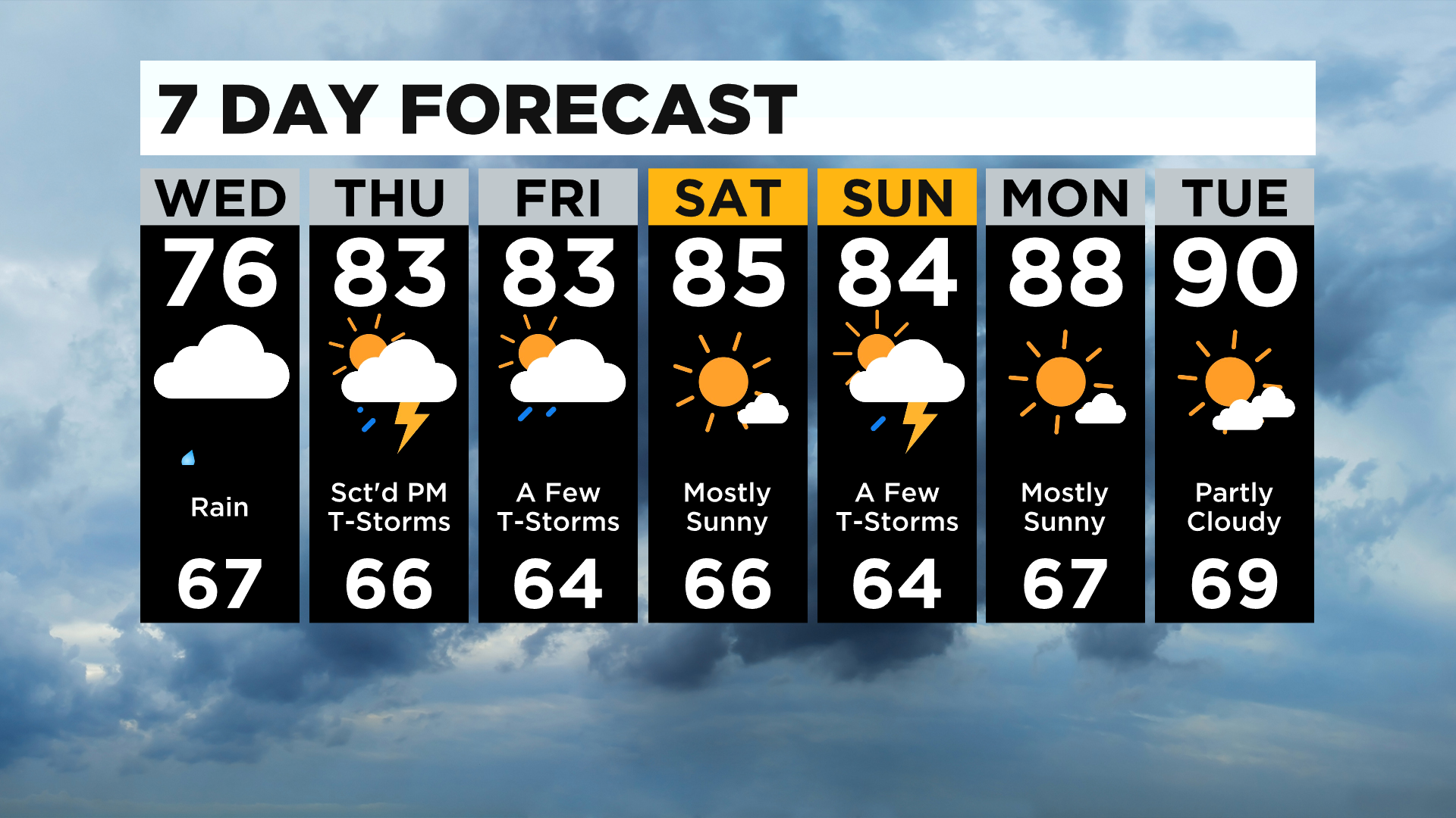
Looking ahead, we return to a more summertime pattern for the rest of the week with highs back into the 80s starting tomorrow and afternoon rain and storm chances on many days.
Tomorrow's rain chance is mainly for places along and south of I-70.
Scattered to isolated storms will also be possible on Friday.
I am keeping Saturday dry and hot right now with highs in the mid-80s.
Sunday will have a low rain chance before dry weather settles in to start the work week next week.
Stay up to date with the KDKA app, which you can download here.