Pittsburgh Weather: Cold Front Expected To Bring Afternoon Rain Showers And Possible Thunderstorms
PITTSBURGH (KDKA) - Good morning!
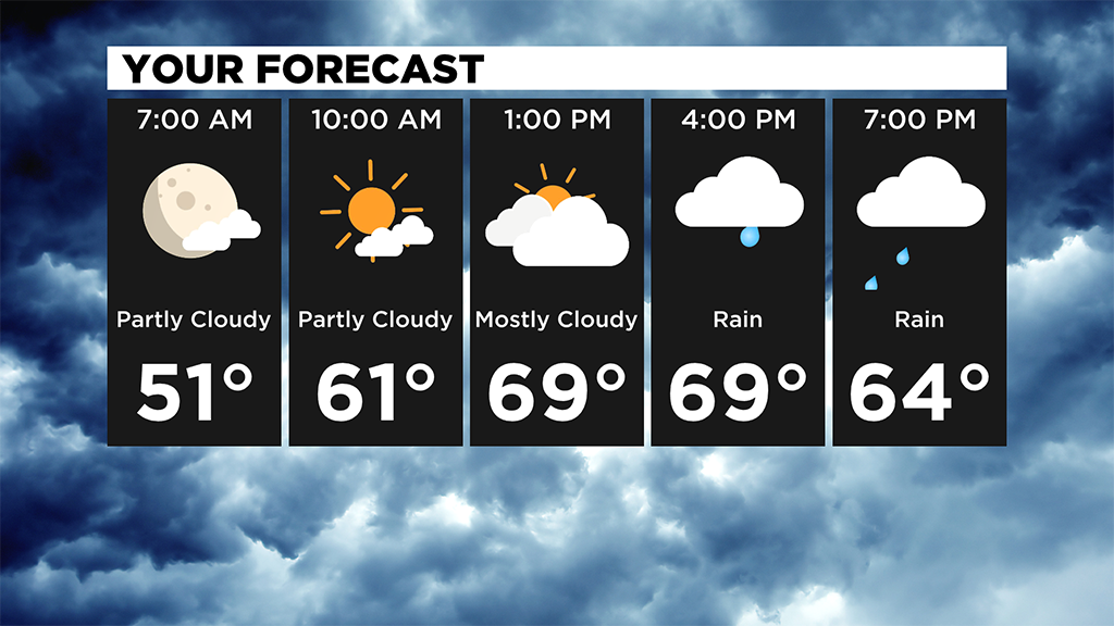
Another seasonable morning with many waking up around 50.
WEATHER LINKS:
Current Conditions | School Delays & Closings | Local Radar | Weather App | Photos
It's a mainly dry start to our morning before a cold front brings rain showers and a few thunderstorms this afternoon and evening.
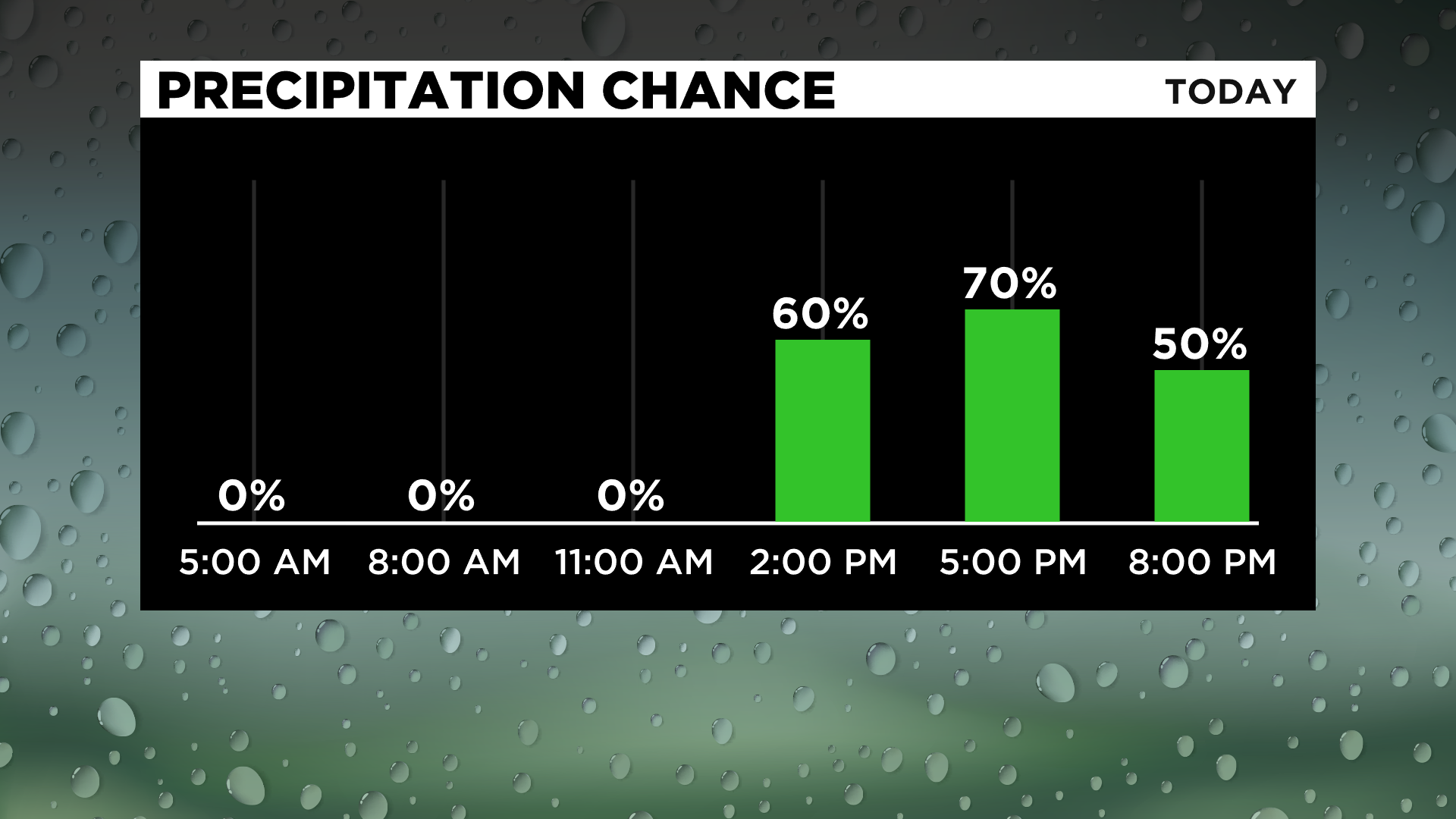
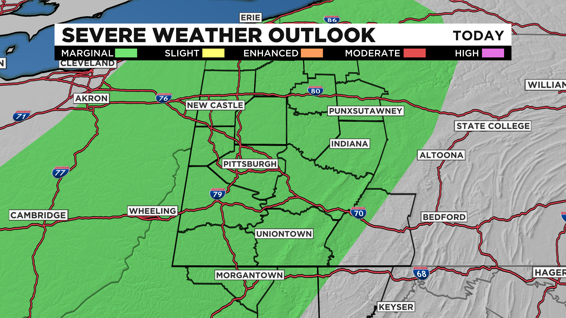
We are under a "marginal risk" for severe weather meaning if we do get any severe storms, they will be very isolated and short-lived. We could have some gusty winds at times around 25-30 mph. Showers will taper off by the night.
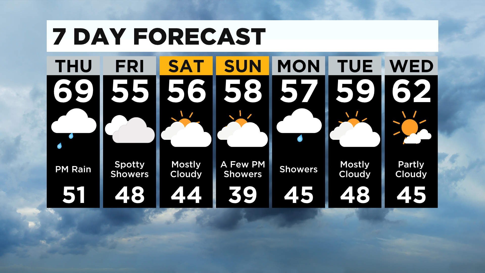
On the backside of the front, we cool back down near 60 for Friday with mostly cloudy skies and highs back around 60. There may be a spotty shower around Friday morning, but it looks mainly dry.
It could be a frosty start to the weekend with lows back in the mid to upper 30s and highs only in the 50s!
It'll be a great weekend for the pumpkin patch or apple picking with some sunshine, but you'll need the jacket!
The only chance for rain is Sunday afternoon but it'll mostly be spotty showers.
Rain returns on Monday with highs staying in the mid to upper 50s.
Stay up to date with the KDKA app, which you can download here.