Pittsburgh Weather: Rain Continues Throughout The Weekend, Flood Watches In Place
PITTSBURGH (KDKA) - Ok, who all felt it?
Let's talk about the "boom" briefly before the forecast.
This morning, before noon, a loud boom could be heard and it even left some houses shaking across western Pennsylvania?
Well, my colleague Ray Petelin had a theory that it wasn't an earthquake, but a meteor.
Shortly after Ray's tweet, the National Weather Service also joined Ray in saying it was not confirmed but "the most likely explanation."
On to the weather!
We ended 8th warmest December since 1875 at 40.9°. We were just shy of tying the year 1881 and 1918 for the 6th warmest on average with those years ending December at 41°. Since 1952 when the observation site was moved to where it is now in Moon Township, we are 2nd warmest December on record with the last warmest being in 2015 at 44.5°.
WEATHER LINKS:
Current Conditions | School Delays & Closings | Local Radar | Weather App | Photos
Normally we should be at 33.7° ending the month which left us 7.2° above normal!
We saw 3.45 inches of precipitation with the normal being 2.84 and we are 7.4" below normal for snow this month with only a .3".
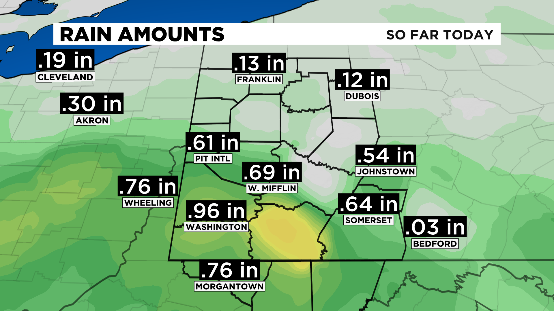
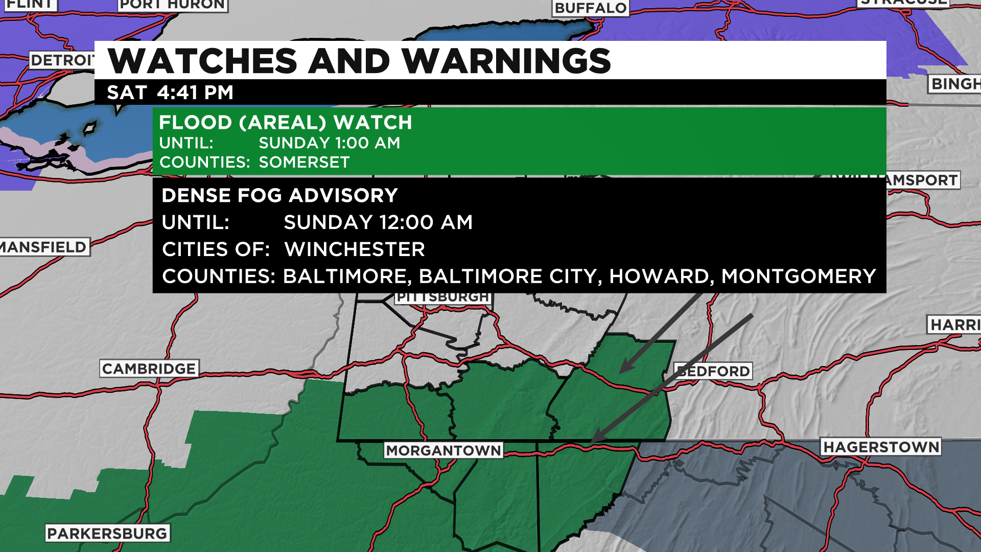
There's a Flood Watch for counties south of I-70 and much of WV.
The Flood Watch for Green, Fayette, and Somerset Co. go until 1:00 a.m. tomorrow.
There's a Flood Advisory for The Ohio River and Mon Warf in Pittsburgh starts tonight at 1:00 a.m. goes until late Monday night.
Use caution when walking near the riverbanks. Right now, the stage is at 17.1 feet. The action stage is 18ft when water flows onto the Mon Warf parking area. The river is forecasted to rise above 18 feet tomorrow morning and rise to 20 feet by Monday morning which is when water is up to one foot deep in the lower areas of the North Shore Riverwalk. The flood stage is 25 feet.
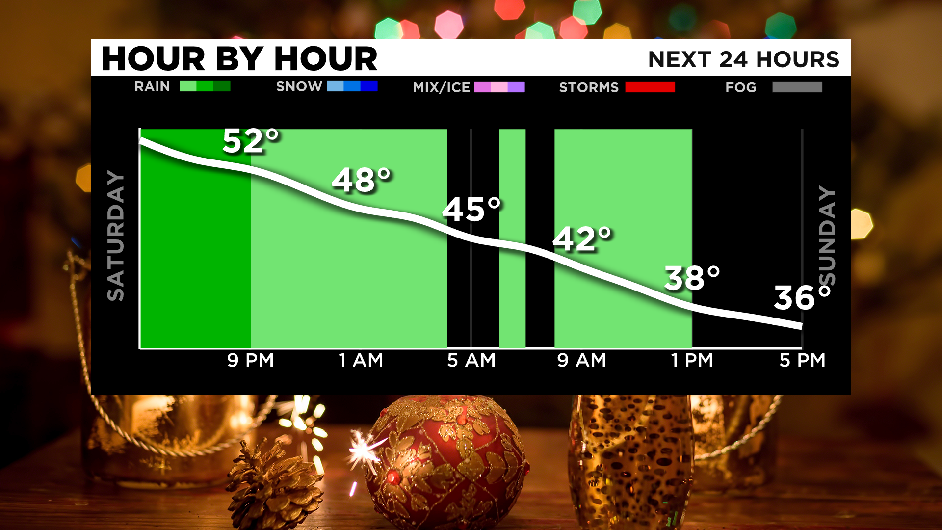
2" of rainfall is possible for some areas south in WV where most of us north of Pittsburgh should stay getting .5"-1" which many already picked up .25" and south of Pittsburgh 1-2" of rainfall with some rates during the afternoon and evening intensifying and many already picking up .50 to 1" this morning and early afternoon.
By tonight temperatures start off in the 40s for Sunday and then fall through the day to the mid-30s. Scattered snow showers tomorrow are possible for areas north of I-80 and along the ridges and Laurels as temps fall and rain switches to snow.
Much needed high pressure builds in for Monday but highs only in the 30s and lows back in the 20s.
We will see sunshine for the first part of the week and temps warm up to the 40s Tuesday and Wednesday.
Our next chance for rain and snow showers will be Thursday.

Stay up to date with the KDKA app, which you can download here.