Pittsburgh Weather: Southern Areas Could See More Snow On Wednesday Night
PITTSBURGH (KDKA) - Snow chances for places south of I-70 along with the Ridges and Laurel Highlands are ticking up this morning.
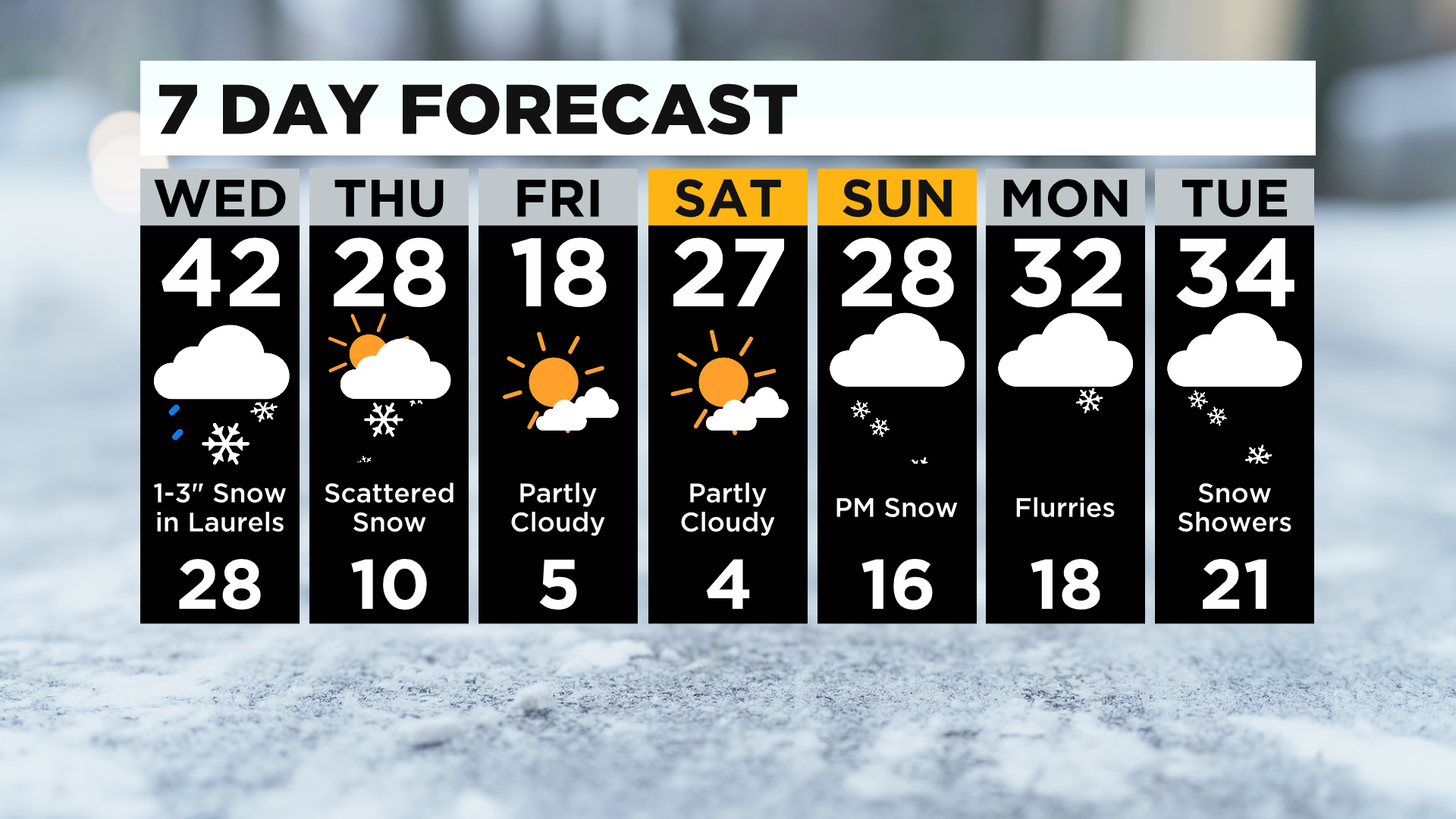
If you are in Greene, Fayette, or Somerset counties you can expect to see between 1-3" of snow. No one else should see more than an inch of snow.
WEATHER LINKS:
Current Conditions | School Delays & Closings | Local Radar | Weather App | Photos
This is only part of a couple of quick-hit weather events that you'll want to know about.

Highs today will be in the 40 and we may already be in the 40s before noon. The last time we hit the 40s here in Pittsburgh was on January 13, six days ago.
Skies will remain mostly cloudy through the day with a chance for light rain arriving after 4:00 p.m.
Rain chances are higher the further south you go from Pittsburgh to the state line. Places north of Pittsburgh likely won't see much in the way. The issue is that the rain showers will wash away the salt protection that is on area roads.
We will then quickly see rain turning over to snow after 8:00 p.m. Road conditions could become slick in the overnight hours due to the set-up that is expected.
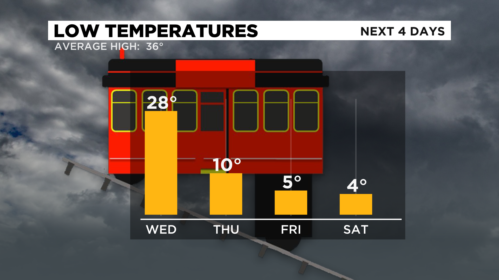
Once the snow ends the cold frigid arctic air rolls in. Some of the coldest weather of the year is expected to move in with highs in the teens on Friday and 20s on Thursday, Saturday, and Sunday.
Stay up to date with the KDKA app, which you can download here.