Pittsburgh Weather: Cold Starts, Not Much Snow Rounds Out The Week
PITTSBURGH (KDKA) - By the time you are likely reading this the coldest temperatures this round have passed us by.
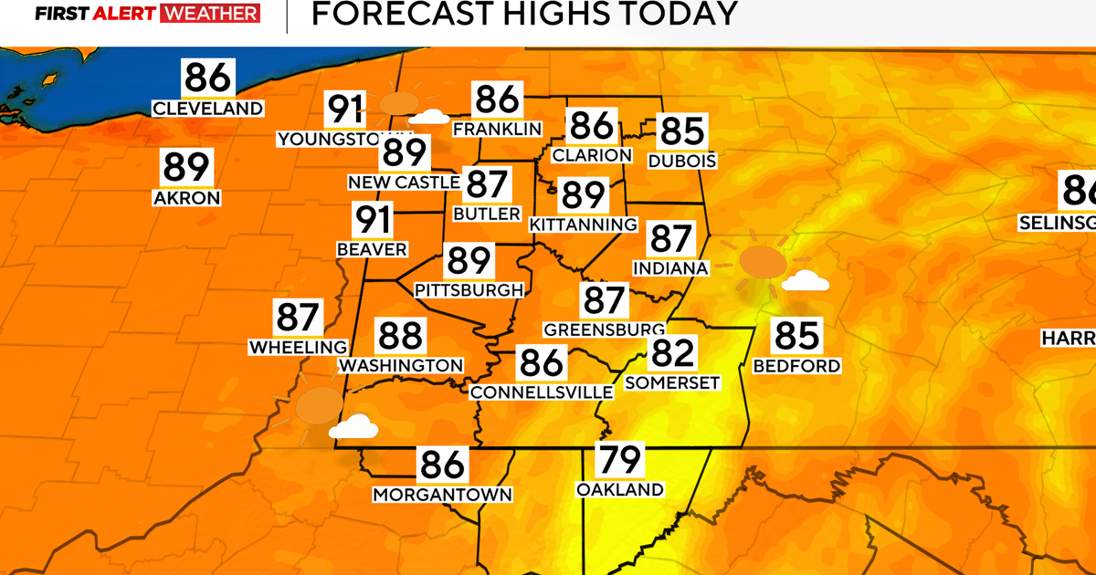
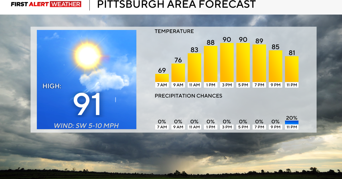
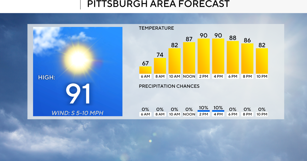
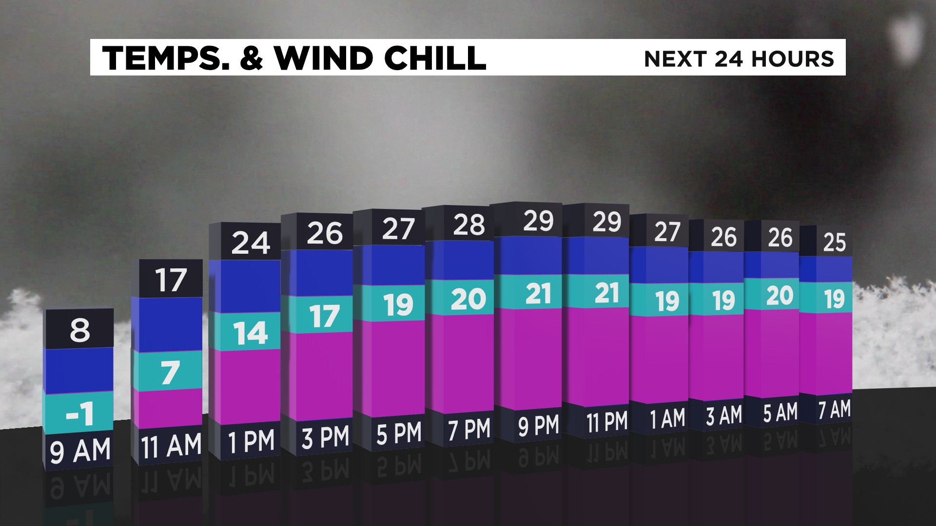
Looking ahead you can expect to see steadily warming temperatures through the day today with highs near 30.
WEATHER LINKS:
Current Conditions | School Delays & Closings | Local Radar | Weather App | Photos
Skies this morning will be clear, with afternoon clouds around.
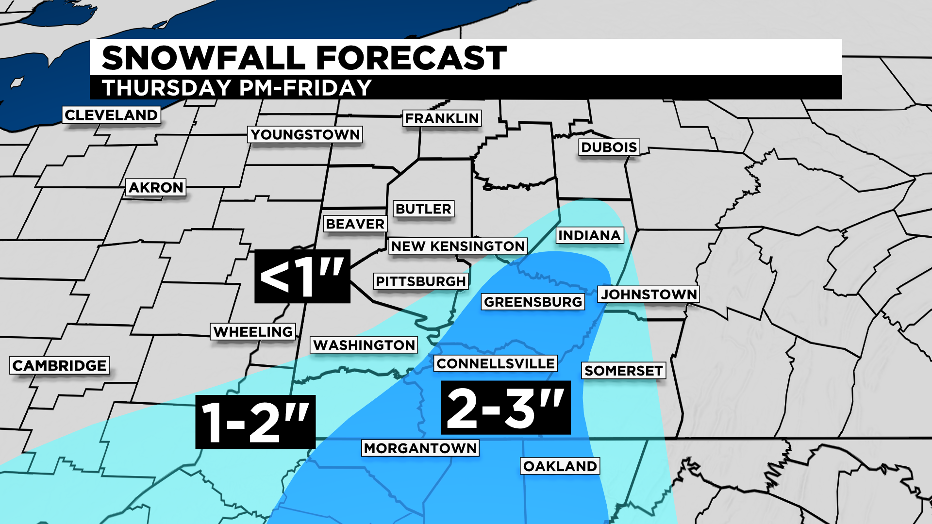
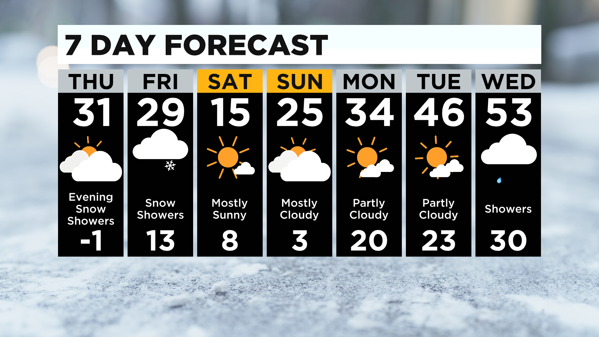
Snow showers will arrive this evening around 8:00, with snow continuing through Friday.
If you are in Pittsburgh, snow totals will be light, less than an inch. Totals could top an inch though for Westmoreland and Fayette counties. The Laurel Highlands could see up to three inches of snow.
My concern at this point is the Friday morning rush.
At this point it doesn't look like snow should have much of an impact for most with only minor issues on roads.
Looking ahead, the snow on Friday is brought to us due to a cold front sinking down from the north.
The cold air behind the front will be in place throughout the day on Saturday and Sunday. When it comes to wind chills, Saturday's chill is forecast to be lower than this morning's chill. Sunday will also see very cold and dangerous temperatures.
If you're ready for a warm-up we will see one next week, but it doesn't look like it is going to stick around very long.
I have Wednesday's highs hitting the 50s.
Yesterday it appeared the warm air was going to stick around for a couple of days but that is not the case anymore with us cooling down before getting to next weekend.
Also, rain showers will be around through the day on Wednesday with temperatures surging to the 50s.
Talk about a missed opportunity!
Stay up to date with the KDKA app, which you can download here.