Pittsburgh Weather: Cold Start To A Warmer Week Ahead
PITTSBURGH (KDKA) -- We are waking up to another frigid start with lows in the single digits and wind chills are also below zero.
The low was 2° at midnight.
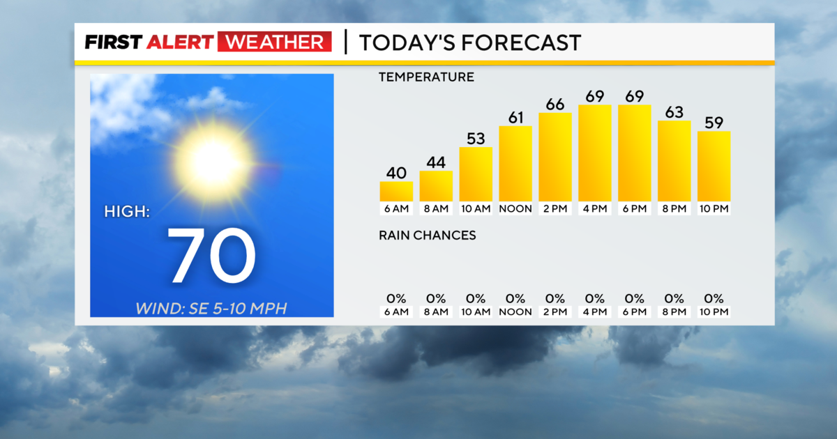
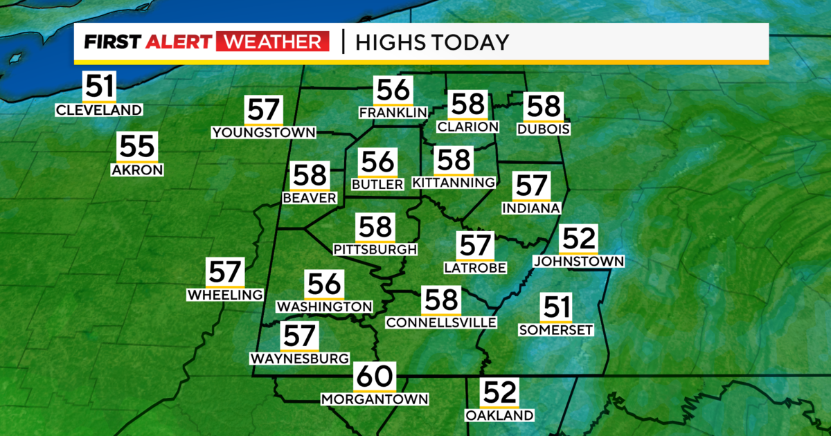
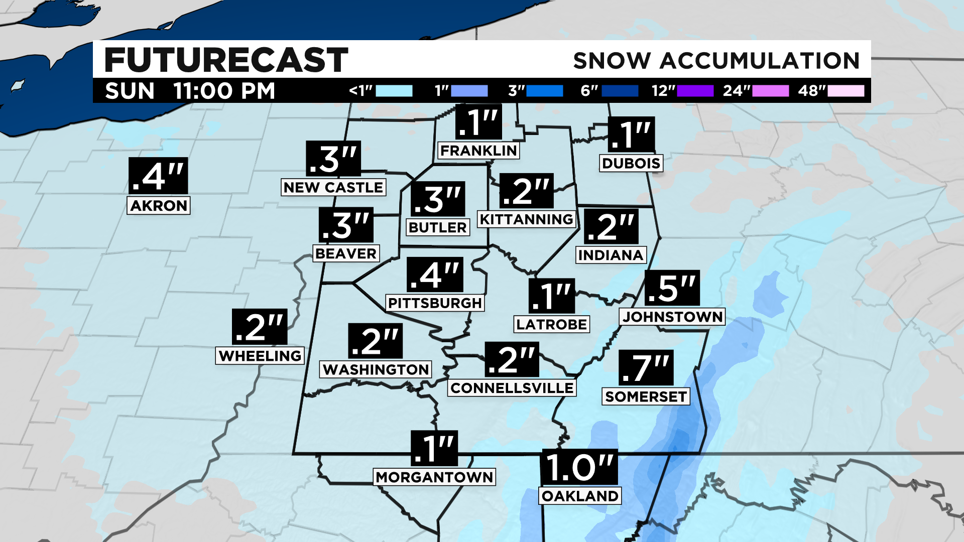
It will get a little warmer today back in the mid to upper 20s, but there are a few scattered snow showers possible this afternoon and evening with little to no accumulation expected.
January is looking to end as the snowiest since 2011 with 19.2" of snow.
In 2011, there was 24.1" and the snowiest was back in 1978 of 40.2".
The normal for the month should be around 12.4".
After today we are in for a thaw (finally).
February is off to an above normal start with highs above freezing Monday with sunshine and in the mid 40s starting Tuesday with dry conditions.
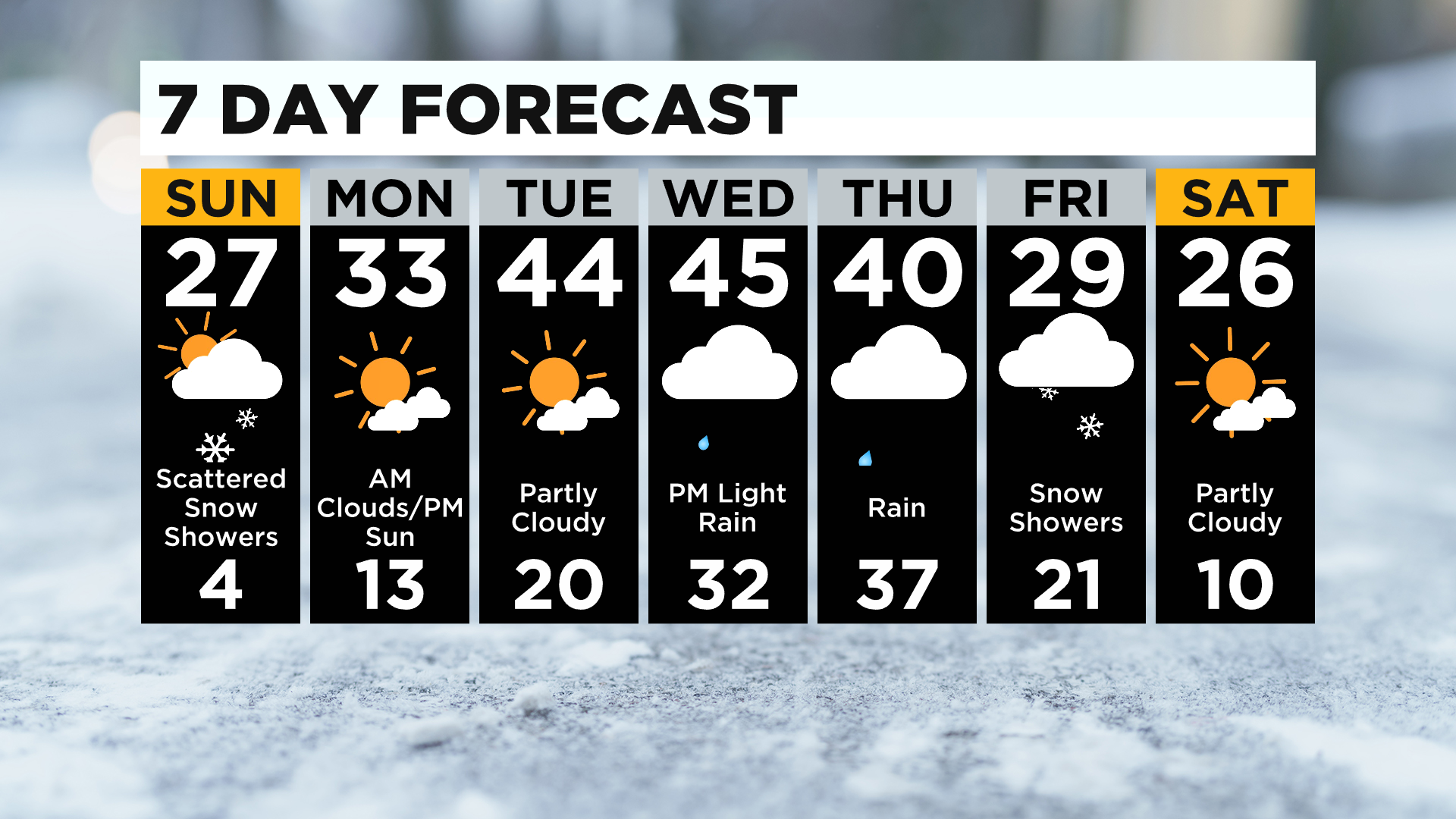
January is ending well below normal by nearly 5 degrees.
Wednesday and Thursday there's a chance for rain and a few snow showers but highs will be in the 40s and then back to the 20s Friday with snow showers and Saturday sunshine returns.
WEATHER LINKS:
Current Conditions | School Delays & Closings | Local Radar | Weather App | Photos