Pittsburgh Weather: A Break From The Cold Temperatures And Snow Starts The Week
PITTSBURGH (KDKA) - Loved the sunshine!
WEATHER LINKS:
Current Conditions | School Delays & Closings | Local Radar | Weather App | Photos
Sunshine, clear skies, and warm air moved in from the southwest and combined to push our temperatures into the 30s today (a far cry from the single digits temperatures this morning).
A few clouds will roll in tonight and temperatures will not be nearly as cold with lows only in the lower 20s.
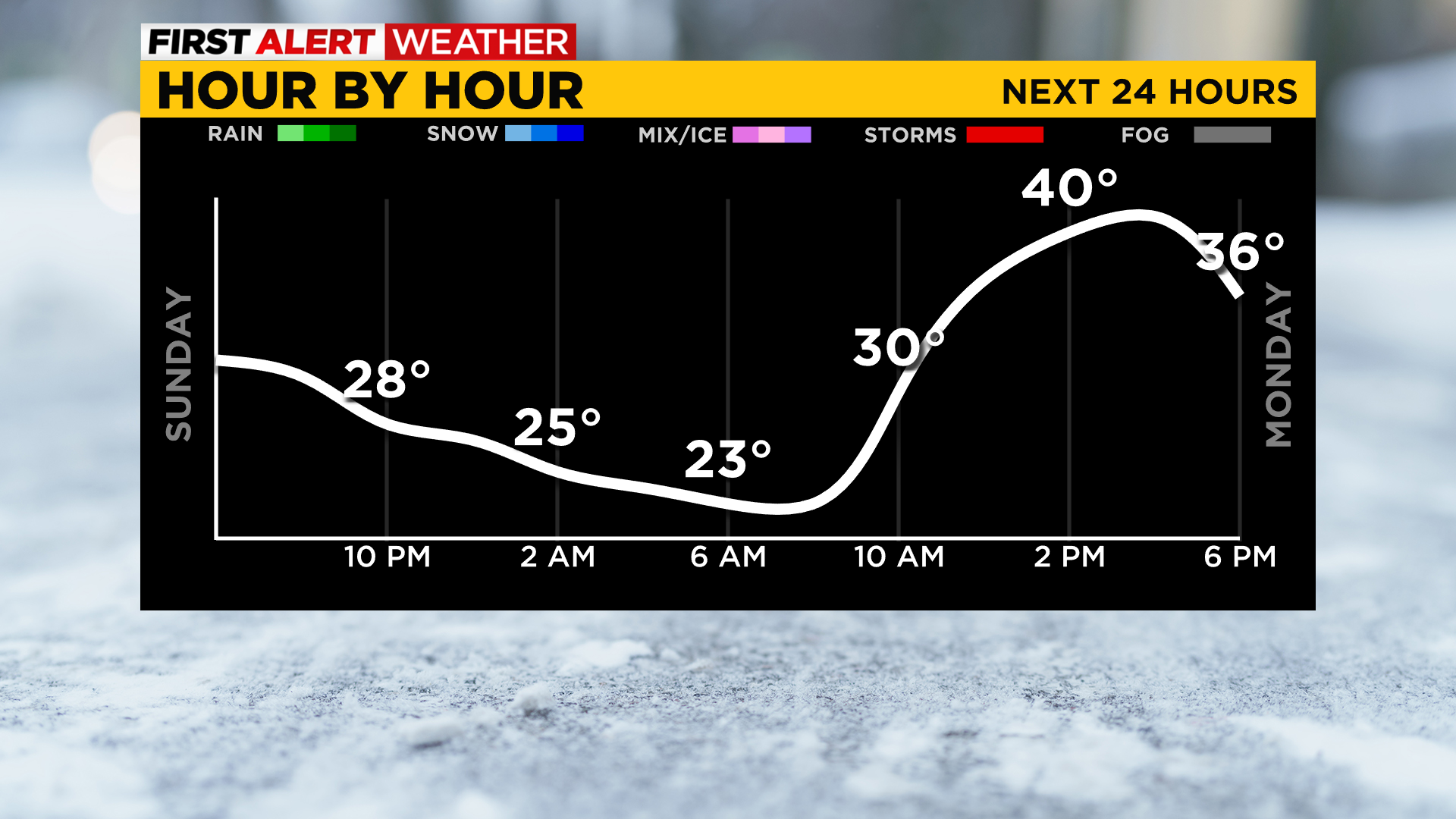
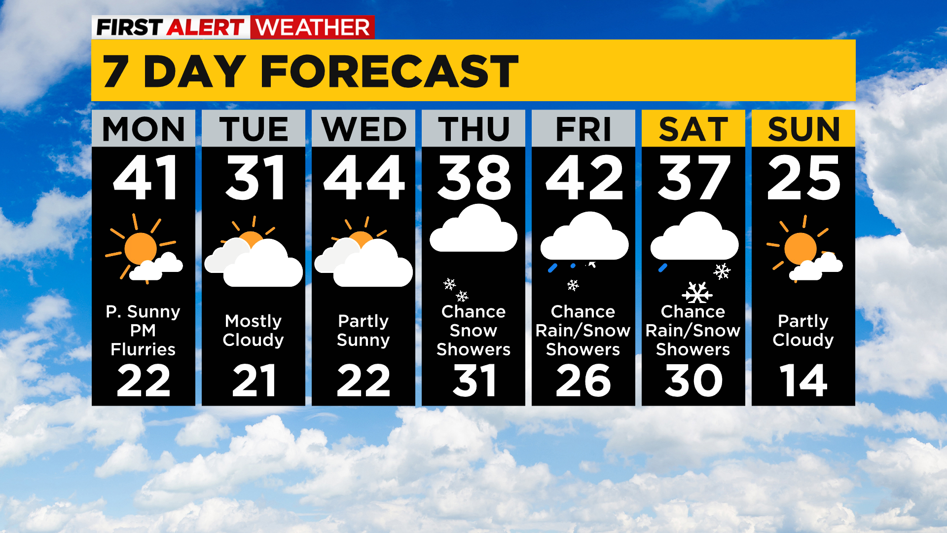
Monday will bring another nudge in high temperatures into the lower 40s in most spots with a few clouds increasing through the afternoon.
A disturbance dropping down off the Great Lakes will bring a chance of flurries and a few snow showers tomorrow late evening into Tuesday morning leaving a dusting or up to a half-inch at most in higher elevations of the Laurel Mountains.
Temperatures cool a bit behind that system but recover midweek and stay seasonable in the upper 30s to lower 40s most of the week.
Another system arriving Thursday-Friday could bring our next chance of a few snow showers or rain/snow showers.
Stay up to date with the KDKA app, which you can download here.