Pittsburgh Weather: Temperatures Soar Over The Weekend, Rain Expected On Sunday
PITTSBURGH (KDKA) - You may or may not be familiar with the term "wish-casting." It generally is used as a statement when a forecaster ignores reasonable data and elevates only the parts that he or she wants to happen.
Right Now: Coldest start of the next week.
Alert: None.
Aware: Wind gusts up to 40mph possible on Sunday, Heavy rain may cause some flooding of low lying areas Monday… Chances ticking up just barely for a First Alert Day for early next week.
So for a weather forecaster like myself, sometimes I see an extra degree or two of warmth during times of the year when data generally is showing that temperatures are likely going to be a little cooler.
WEATHER LINKS:
Current Conditions | School Delays & Closings | Local Radar | Weather App | Photos
I mention "wish-casting" because it happened to me yesterday.
We got in a single dry Sunday morning model "run" and I jumped on it.
Now, to be clear, no data was showing, and Sunday morning rain was yesterday morning. Data and the conditions that are expected to be in place though should have triggered caution for me in pulling back rain chances. I even thought while forecasting yesterday, "you better hope those rain chances don't come back."
Guess what?
They're back and I am kicking myself for taking the rain out of the forecast for Sunday morning yesterday.
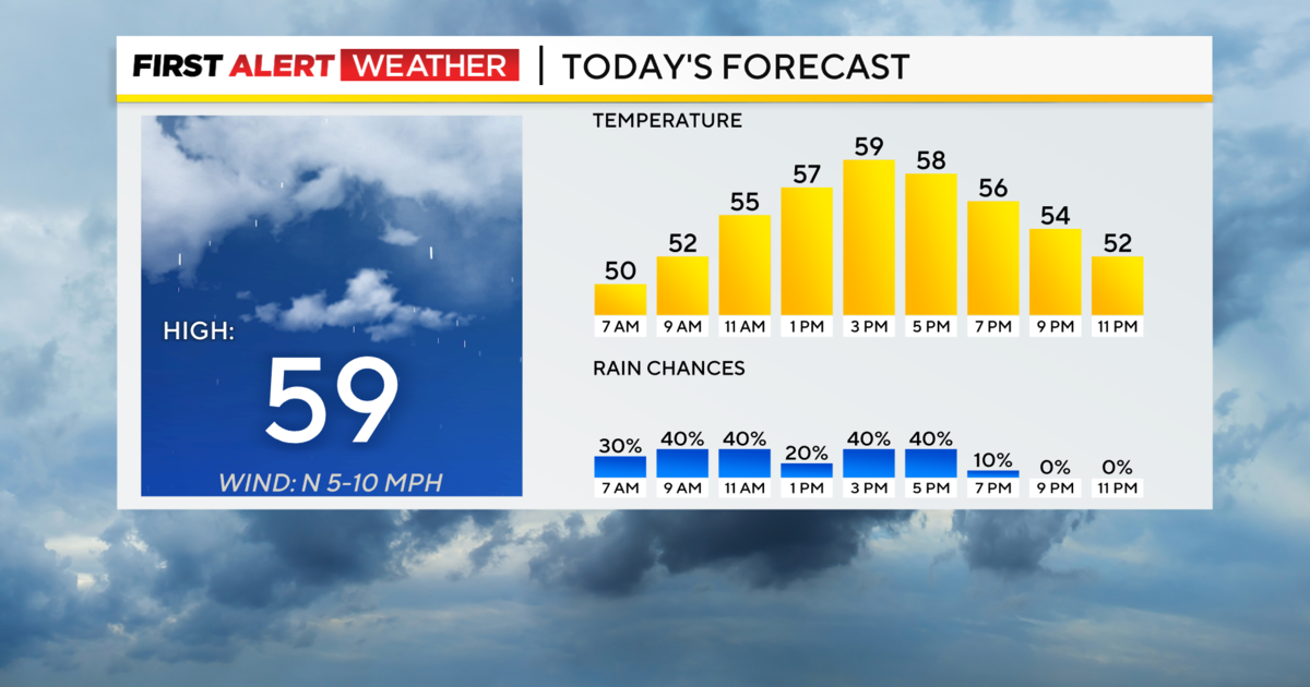
Now that I have that out of the way let's talk about today's weather.
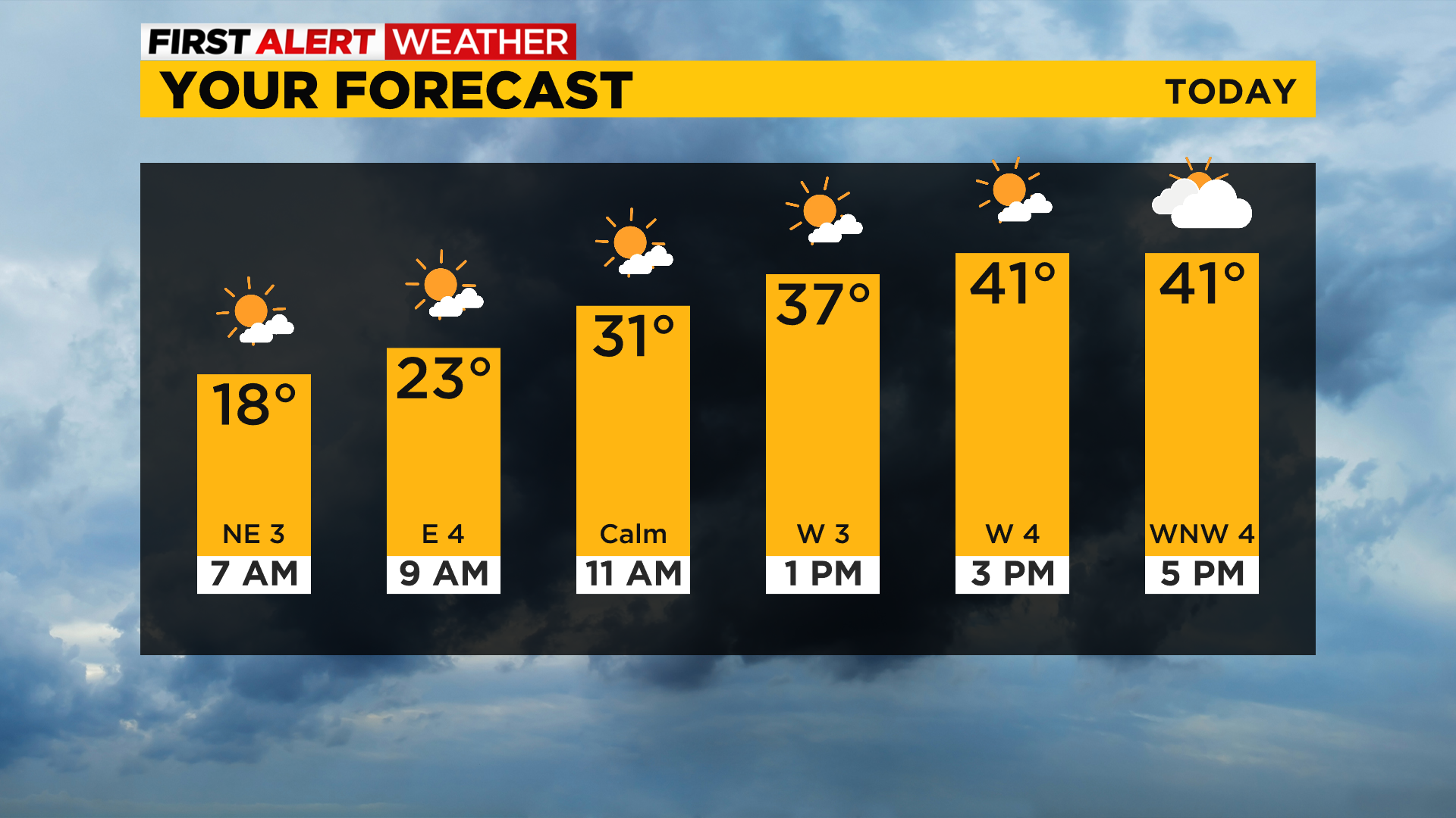
This morning will be the coldest start we will see over the next week with lows bottoming out in the mid to upper teens. I have Pittsburgh's low dipping to 17°. We should see plenty of sunshine today, especially this morning. Clouds thicken this afternoon with highs in the mid-to-low 40s and noon temperatures just in the low 30s.
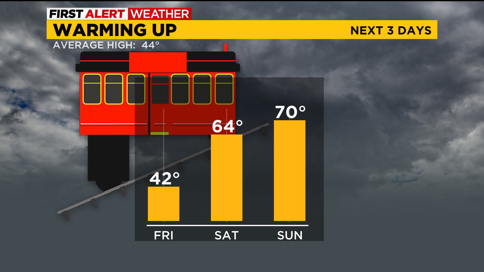
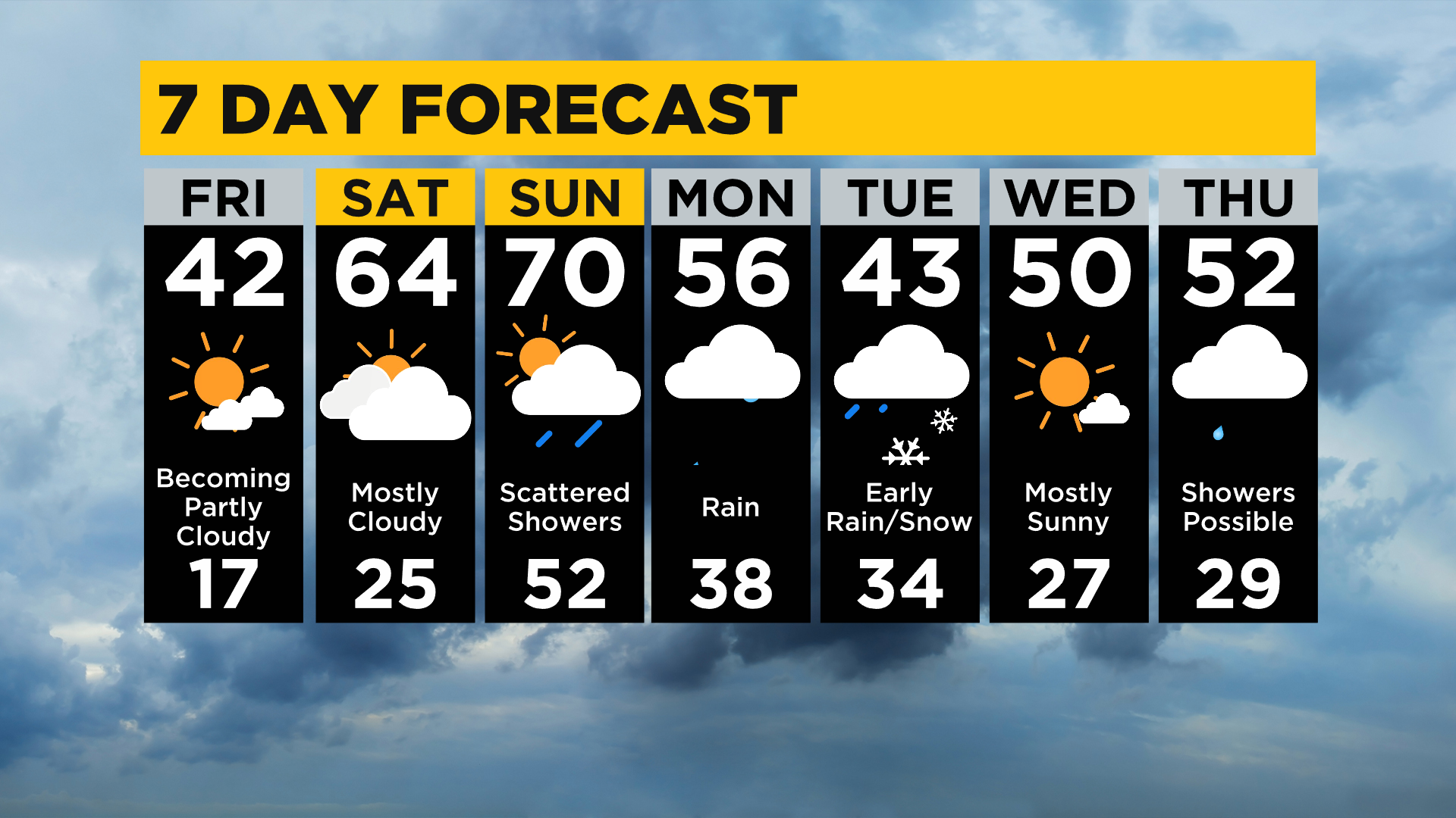
Saturday also will be dry with morning lows in the mid-20s and highs in the mid-60s!
Rain showers will be around on Sunday before most even wake up. As the powerful system ticks to the east windy conditions should be expected with wind gusts nearing 40 mph later in the day. Rain totals for Sunday shouldn't be too high and will likely be around a fifth of an inch.
Rain rates pick up Sunday evening and through the overnight hours. There will be a period on Monday where it looks like we could pick up around an inch of rain in just around 10 hours.
The concern continues to be with some minor low-level flooding being possible along with this being 'fuel' for continued issues with ongoing landslides.
Monday rain totals should be around an inch to an inch and a half.
Just a heads up winter weather isn't done with us just yet.
The first winter weather could come on the bask side of Monday's system.
Looking way out, the end of next week also is showing some hints of potential accumulating snow with a couple of our long-range models.
Stay up to date with the KDKA app, which you can download here.