Pittsburgh Weather: Rain Becomes More Steady Sunday Night Into Monday
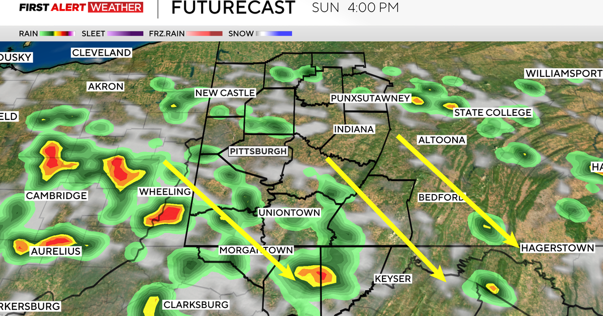
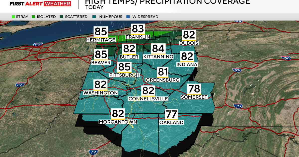
PITTSBURGH (KDKA) - Another unseasonably warm day pushed temperatures into the upper 60s and now the warm front lifting across the region is providing another round of scattered showers.
Aware: Wind advisory will expire for our northwest counties at 7pm. Showers are moving back into the area in spots and will increase through the evening/overnight. Monday will be soggy with around 1" of rain and a few storm possible south into Northern WV.
Alert: None
That activity will increase through the late evening and become a steadier rain overnight into Monday morning.
WEATHER LINKS:
Current Conditions | School Delays & Closings | Local Radar | Weather App | Photos
We're in the "marginal" risk category through tomorrow morning for any storm activity and through the day tomorrow areas to the south through Northern WV get bumped up into the slight risk category for severe weather. The main threat would be gusty winds and it will be a bit breezy across the entire region all the way through tomorrow evening.
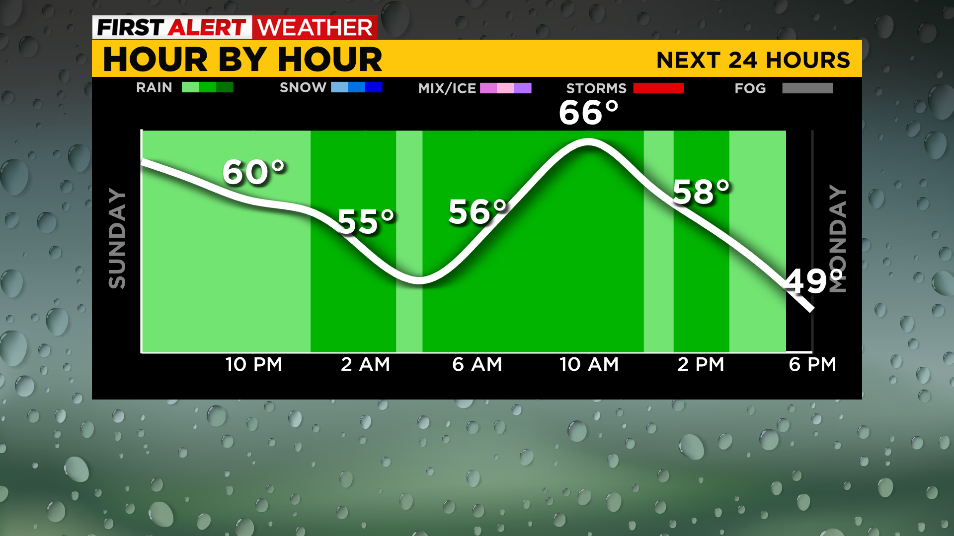
Rain becomes more steady toward morning and models are still showing around 1" to 1.50" of rain by later tomorrow evening before the cold front crosses. Widespread flooding is not anticipated.
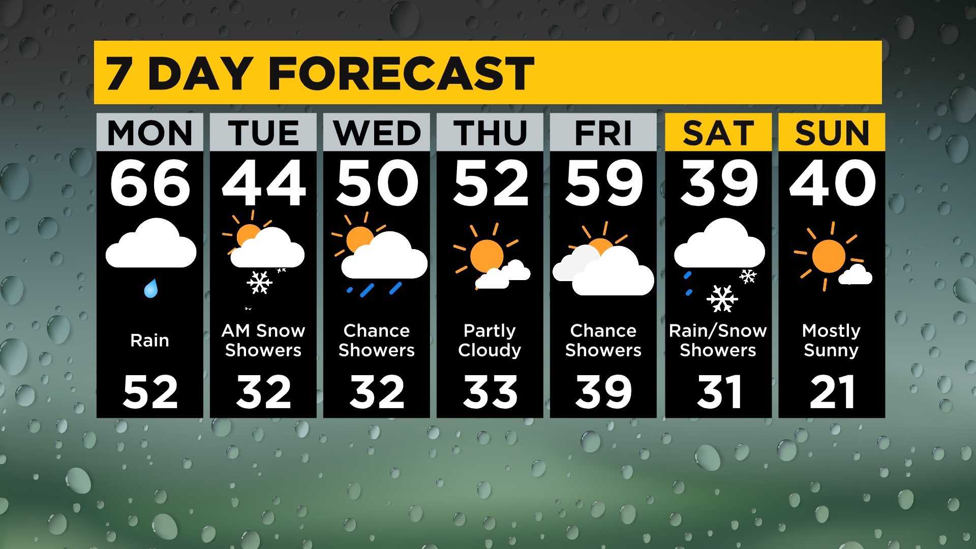
The cold front will snap us back into reality tomorrow later as temperatures start dropping into the late afternoon/evening and will only recover closer to 40 for highs Tuesday along with a few early morning snow showers.
The rest of the week features highs in the lower 50s before cooler air returns next weekend.
Stay up to date with the KDKA app, which you can download here.