Pittsburgh Weather: Cloudy, Cool Conditions Ahead Of Mixed Bag Of Precipitation
By: Kristin Emery/Ron Smiley/KDKA-TV News Staff
PITTSBURGH (KDKA) -- Today will be dry with cloudy skies, but it's later in the week that could cause some problems.
Highs today will get back to just 32 degrees. That's a good 30 degrees colder than yesterday's high.
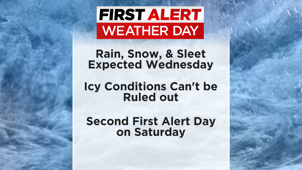
The next chance for precipitation arrives on Wednesday morning. The KDKA Meteorologists have issued a First Alert Weather with rain, sleet and snow expected.
Aware: Flurries/snow showers ending now and quiet/chilly the rest of today.
Alert: First Alert Weather Days WEDNESDAY (mainly in the morning) and SATURDAY (potential winter weather).
WEATHER LINKS
Current Conditions | School Delays & Closings | Local Radar | Weather App | Share Photos
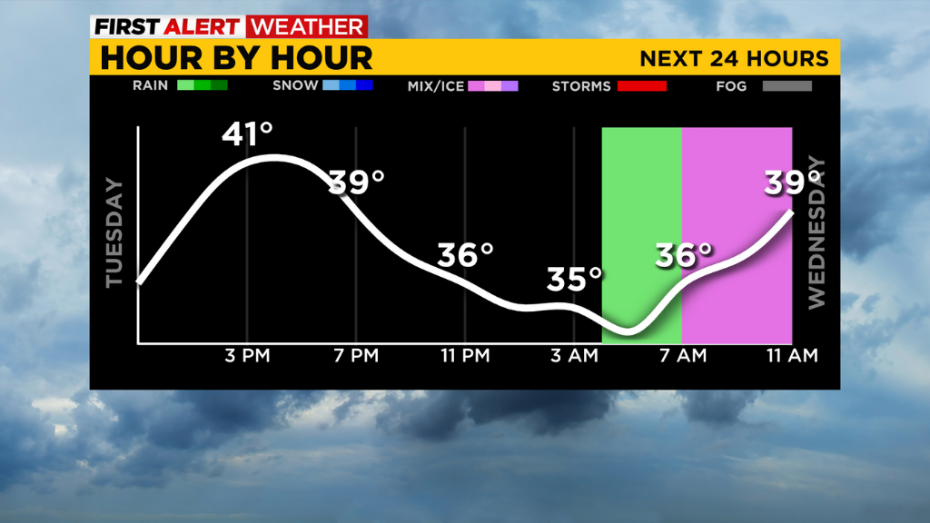
Our Tuesday began with some snow showers and sleet, which have now pretty much ended, but we'll stay mainly overcast and a lot chillier than the past few days with seasonable highs in the lower 40s.
Another batch of moisture heads our way overnight from the south and it will arrive as some rain and mix that change over to some snow showers through the morning hours. We'll have a First Alert Weather Day in effect Wednesday.
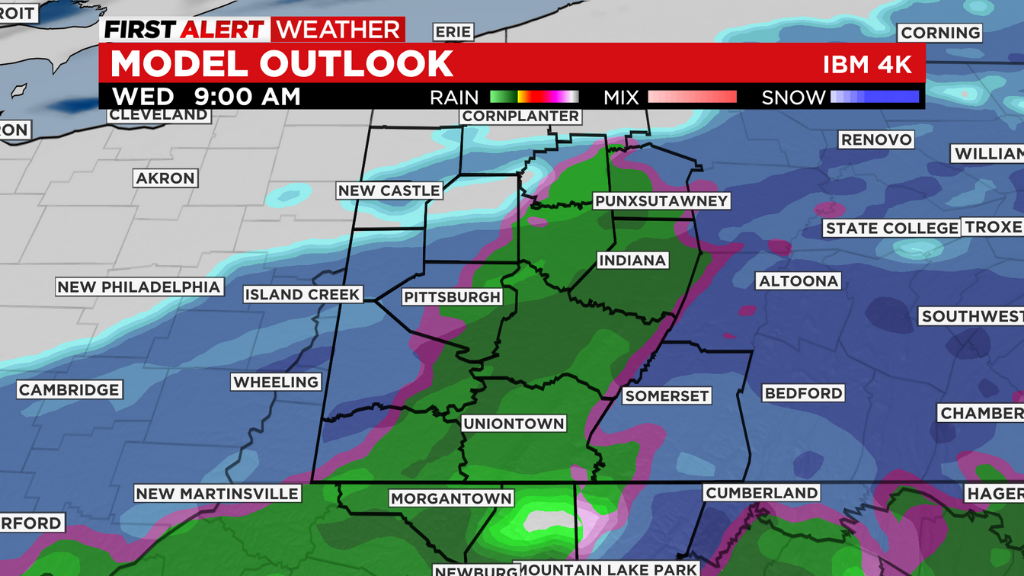
The main impact hours will be from rain starting to the south around 4 a.m. and everyone getting some rain/snow showers through lunch. The Laurel Highlands could see an inch or so of accumulation and we could get a minor accumulation in spots (especially N and W of Pittsburgh).
Much of what falls will melt, but roads could be slippery.
We'll dry out through the afternoon and temps rebound to the 50s Thursday.
Attention then turns to Saturday for another First Alert Weather Day. We want to alert you to possible winter weather and potential accumulating snow. We'll have a better idea of timing and snow potential in the next day or two and we will keep you informed as we know more and track this next approaching system.
Stay up to date with the KDKA app, which you can download here.


