Pittsburgh Weather: First Alert Day In Effect As Snow Approaches Region
PITTSBURGH (KDKA) - New advisories and warnings are now down and I mostly agree with the solution the NWS went with.
Right Now: Evening rain and snow chance. Little impact until evening hours.
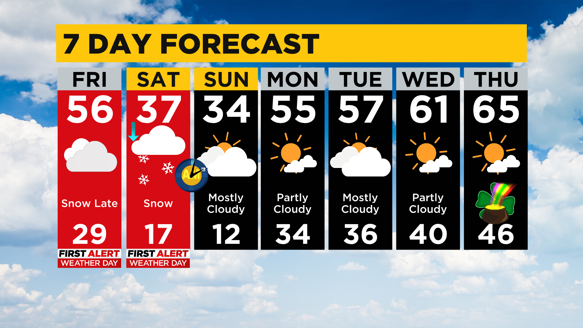
Alert: Saturday snow totals of 4-6" should be expected with most snow falling before noon. St Patty's Day Parades going on Saturday morning will be impacted. Both today (late) and tomorrow (heaviest in the morning) are First Alert Days.
Aware: Sunday lows drop to near 10°. Nice warm-up occurs as we head into the next work week with high temperatures back near the 60s.

They have painted most of our area under a Winter Weather Advisory that begins late tonight and extends through noon on Saturday.
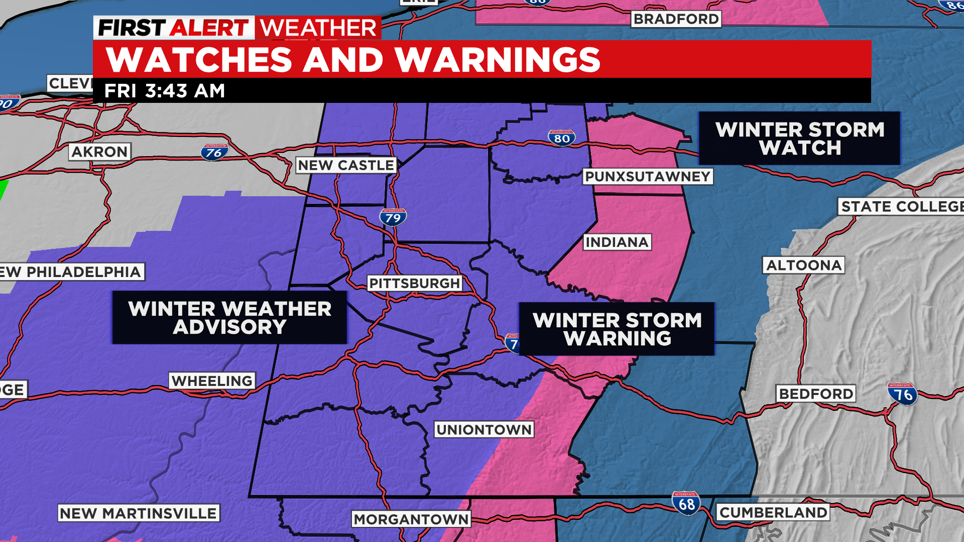
Here's my nitpick: this has been consistent with my forecast all week long. Most of the accumulating snow will occur in Pittsburgh from 3 a.m. on Saturday morning through 8 a.m. on Saturday. This is where the lion's share of the 4-6" we are calling for will fall.
WEATHER LINKS:
Current Conditions | School Delays & Closings | Local Radar | Weather App | Photos
For the rest of Saturday places may see an additional inch of snow but to tell you the truth I'd take the under if someone wanted to place a bet on it.
The craziest weather will be confined to the places under a winter storm warning. Not only will you see big snow totals through the entire day on Saturday but winds will be gusting up to 40mph. Temperatures will also be falling through the day.
It's great news for skiers and boarders. Enjoy another great weekend in the Laurels.
For today, highs will be in the mid-50s after we hit 48 yesterday for a high. Yesterday I knew the temperature for today was too low (or had a strong feeling) but held off on changing it due to the big snow system.
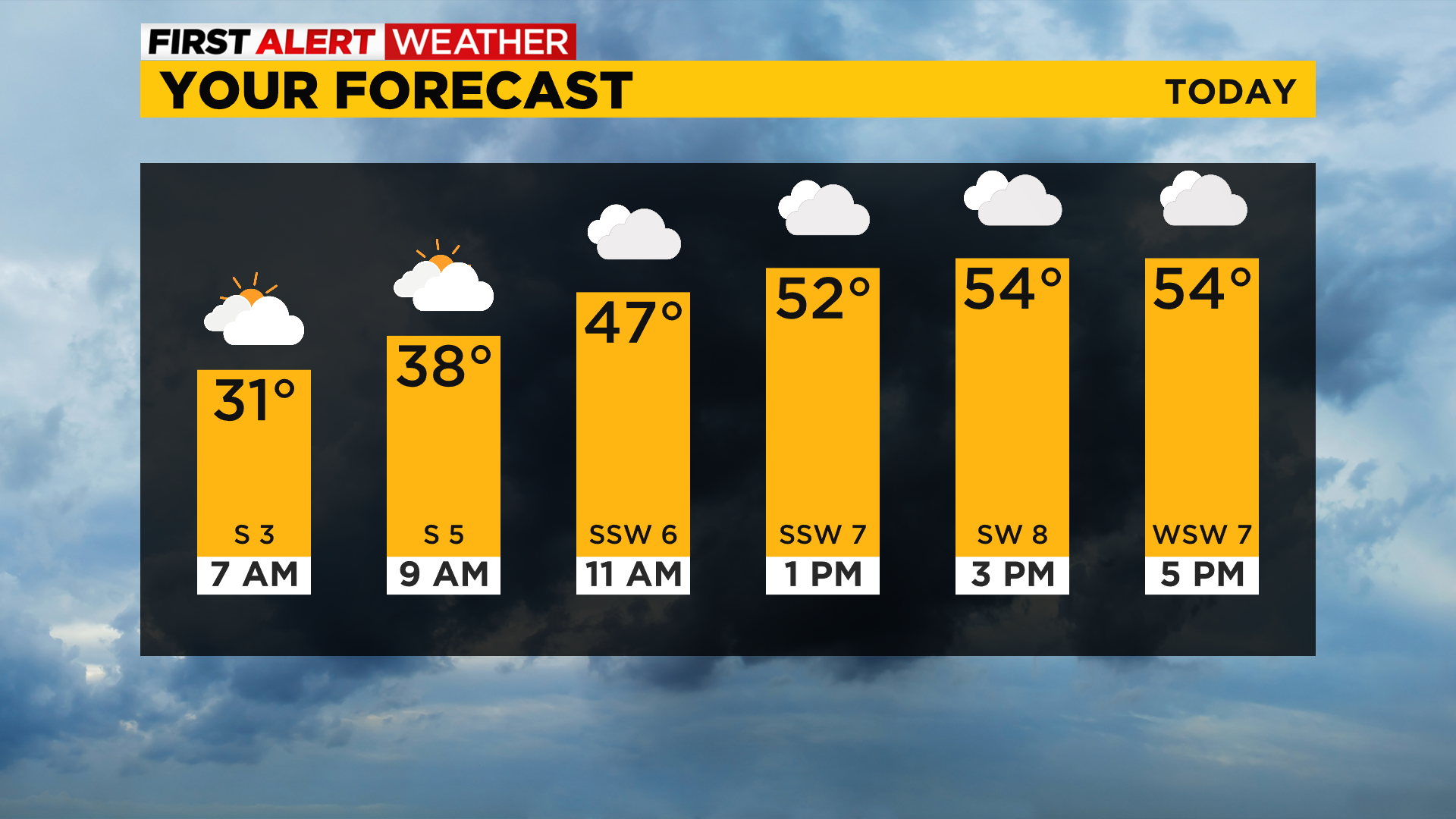
I don't know that I would have forecast highs in the mid-50s yesterday (with data still showing highs near 50) but I knew that temperatures technically should be warmer today. Enjoy the pleasant weather because today will be the best of the weekend.
Quickly looking at next week, highs will be back in the 50s by Monday with temperatures in the 60s by next Wednesday.
Most of next week is looking dry with a small chance for rain on Thursday.
Stay up to date with the KDKA app, which you can download here.