Winter-Like Temperatures Return To Region, Prompt Winter Weather Advisory
PITTSBURGH (KDKA) – Winter-like temperatures returned to the region this weekend, with lows set to match a 20-year record.
The record low for April is 18 degrees, set in 1997, and according to KDKA's Jon Burnett, Sunday's low is set to match that record or potentially go even lower. The normal high for this time of year is 59 degrees, but the region was seeing temperatures well below that, with a high of 36 on Saturday and the "feels like" temperature only in the upper teens with wind chill.
A Winter Weather Advisory was issued for much of the area and remains in effect until 5 p.m. Saturday for the following counties:
Allegheny, Armstrong, Beaver, Butler, Cambria, Clarion, Fayette, Forest, Indiana, Lawrence, Mercer, Somerset, Venango, and Westmoreland
Join The Conversation On The KDKA Facebook Page
Stay Up To Date, Follow KDKA On Twitter
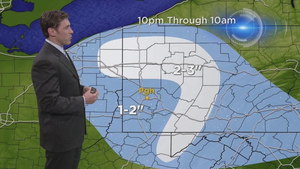
Some snowfall was expected overnight and early Saturday morning, but Burnett reported around 7 a.m. Saturday that it should start to taper into flurries.
"Now, accumulation totals are going to be modest from this point on. Probably another coating to an inch on top of whatever you have seen so far," Burnett said, "and that would include as much as 2 or 3 inches in northern and eastern parts of the viewing area, over in the Laurel Highlands, the higher elevations, and north of interstate 80. They've already had a couple of inches with another inch or two to go."
The Pittsburgh Public Works Department issued a Level 1 Snow Alert on Friday night and had vehicles out salting the roads overnight to prevent slick conditions Saturday morning.
"Level 1 is basically a storm where we expect less than two inches of snow," said Pittsburgh Chief Operations Officer Guy Costa. "Basically, we'll be in a salting mode overnight into [Saturday]. If we get more snow than anticipated plows will be added to the trucks."
PennDOT also said they would be monitoring conditions.
"We'll have crews out [Friday night]. We'll be monitoring the forecast to see how it's going to come in. We'll pre-treat the roadways if it doesn't come in as rain and we'll have crews on all night till the storm ends," said PennDOT's Steve Cowan. "Please drive safely, slow down, know that especially bridges and overpasses and ramps can be very slick."
Temperatures will fall into the mid-to-upper teens overnight, but no additional accumulation is expected until showers return on Monday.
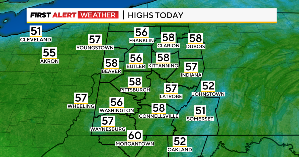
Spring weather will start to make its return later this week, although the highs are still below normal, only reaching mild temperatures in the 50s. The 14-day temperature trend, however, shows that highs in the 60s and low 70s could be on their own in the upcoming weeks.
Stay With KDKA.com for the latest on the weather conditions.