With 1st Snowfall Recorded, Could More Be Coming Soon?
PITTSBURGH (KDKA) - Every week over the winter weather months I am going to be writing a blog about potential snowfall specifically focused on the upcoming week. On top of that, I would like to look ahead (sometimes way ahead) at what the weather may be like due to what's happening right now in our atmosphere.
As it stands, western Pennsylvania saw the first snow of the season in higher elevations over the weekend. When forecasting the snow, I tried to make a point of not saying "flurries" because I thought it was going to be a fairly good snow and it was.
This video was retweeted from the Seven Springs Twitter account.
It's SNOWING at @7SpringsPA ❄️❄️❄️ #FeelsLikeWinter #FirstSnow pic.twitter.com/M6WEIRrnRG
— Abbey Way (@abbeyway11) October 22, 2016
Davis, Pennsylvania recorded 0.6 inches of snow on Saturday morning, according to the National Weather Service.
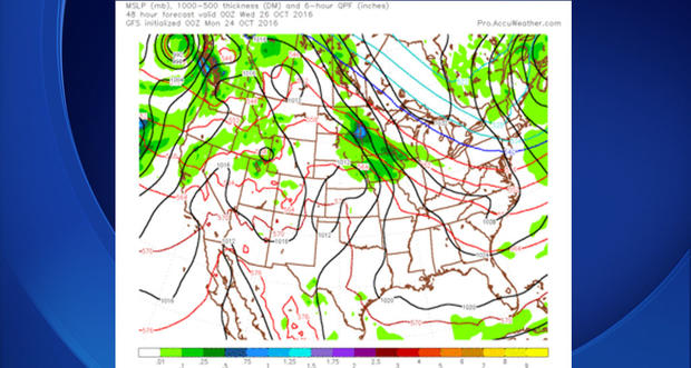
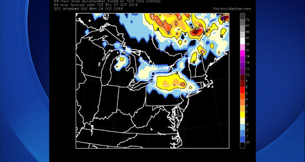
Looking at the week ahead, two clipper lows will clip our area. While the 540 line (snow line) is expected to remain well north of Pennsylvania, the GFS is continuing to show a chance for snow on Thursday, on the back side of the first clipper for northern parts of the state.
You can see its output of accumulating snow below:
The secondary clipper likely won't bring snow anywhere close to Pennsylvania. It will be fast moving and will likely mean a cold, windy and rainy start to our Saturday.
If the pattern holds this will be the first time in a while that Pittsburgh hasn't seen at least a trace amount of snow at the Pittsburgh International Airport in October. The last time we recorded no snow in October was in 2010. That season was also a year where we were transitioning into La Nina.
In that year, we only saw a trace amount of snow in November before getting on track with snow in December where 12.2 inches of snow fell. January and February of 2011 saw 38 inches of snow falling, so the slow start may not mean much.
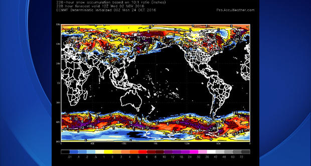
Recent research has also pointed out that Siberian Snow Pack in October may be just as important in determining long-term winter snow impacts than looking at either El Nino and La Nina wind patterns.
While research is looking at ways to narrow exactly where we need to look in order to theorize the impact here at home, a large look at Siberia over the next week shows heavy snow and the beginning of snow pack already being measured in feet and not inches.
They are seeing heavy snows for October and I think that means that we will likely see a year like 2010, where we get off to a slow start, but finish strong with near average snow totals.
Join The Conversation On The KDKA Facebook Page
Stay Up To Date, Follow KDKA On Twitter