Pittsburgh Weather: 1-2 Inches Of Snow Expected With More In Ridges
Team coverage by: KDKA-TV's Ray Petelin, Mary Ours, Amy Wadas, Erika Stanish and Royce Jones
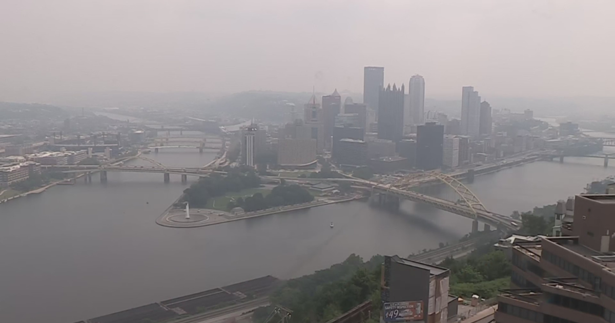
PITTSBURGH (KDKA) -- The winter weather is here. After relatively warm temperatures in December, most of the Pittsburgh area is getting its first measurable snowfall of the season.
A few inches are possible for the Pittsburgh region Thursday evening, with snow picking up around 8 p.m. and going until about 1 a.m.
WATCH: KDKA Meteorologist Ray Petelin's forecast
This is a very fast-moving system, and the ridges are expected to get 5 to 7 inches. This will be significant for eastern parts of Fayette County and a lot of snow for skiers.
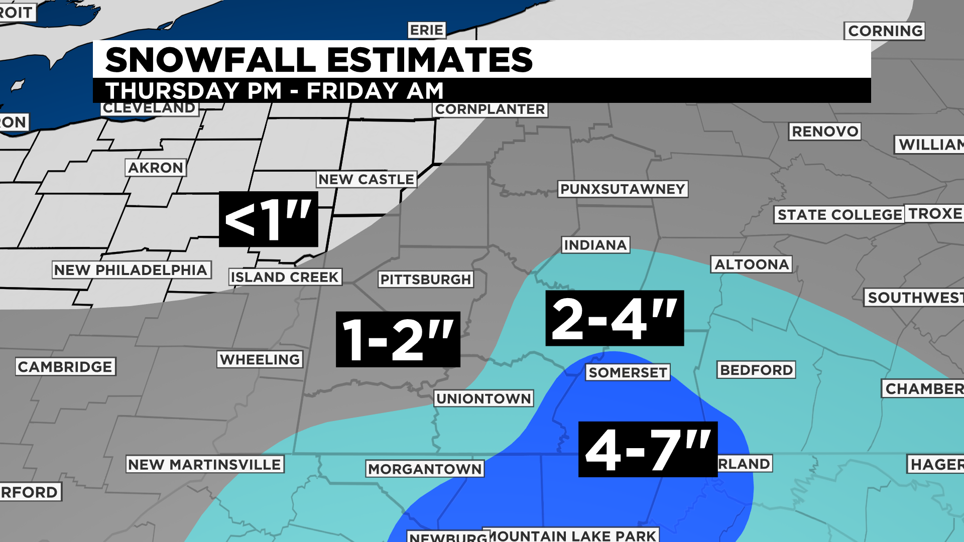
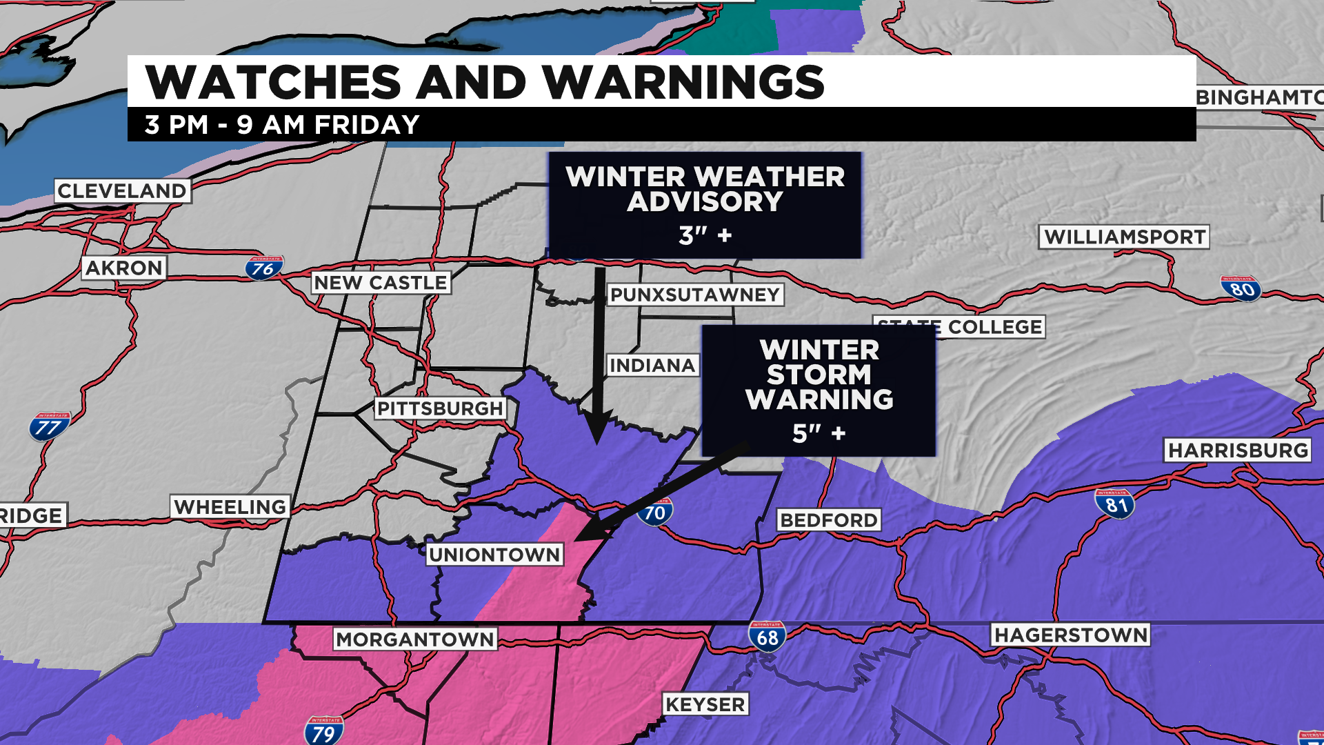
A Winter Weather Advisory was issued in Greene, Fayette, Somerset and Westmoreland counties at 3 p.m. and is scheduled to last until 9 a.m. Friday with a projected 3 inches of snow. A Winter Storm Warning started at 3 p.m. and is going until 9 a.m. Friday for the ridges of Fayette and Garrett counties and northern parts of West Virginia. More than 5 inches of snow are expected in those locations.
Snow started coming down in the city around 6 p.m., with areas south seeing flakes first. KDKA reporters were in Fayette and Westmoreland counties when it started to snow. In Uniontown, it took less than an hour for Route 40 to become covered in snow.

On the Pennsylvania Turnpike in between the New Stanton and Breezewood exits, the speed limit was dropped to 45 miles per hour shortly after 6 p.m.
PennDOT also said the speed limit was reduced to 45 mph on interstates 79, 376, 279 and 579 and State Route 28 in Allegheny County. In Beaver County, Interstate 376 has the same restriction.
WEATHER LINKS
Current Conditions | School Delays & Closings | Local Radar | Weather App | Photos
Crews have been preparing roadways for the snow ahead of time.
PennDOT District 12 -- which covers Fayette, Greene, Washington and Westmoreland counties -- told KDKA's Amy Wadas they've been pre-treating the roads with salt brine, and they were ready to send out crews once the snow hit. They'll be working in 12-hour shifts until the snow is over.
There are some reports of slick spots coming in. In Jeannette, a car crashed into a building.
In Allegheny, Beaver and Lawrence counties, 118 trucks in total will be out in the height of the snowfall. Sixty-six of them will be in Allegheny alone.
Overall, it's a quick-hitting system that could bring a few inches of snow, but it's got good timing. The snow isn't falling during evening rush hour, and it should clear up around 1 a.m., giving crews time to get roads clear for the morning commute.
WATCH: KDKA's Erika Stanish reports
So far, this is the eighth-latest start to snowfall for Pittsburgh on record with 1.8 inches. The winters of 2015-16 had 1 inch and 2006-07 had 0.7 inches.
Temperatures will be below freezing until Saturday afternoon, when our area gets into the mid-30s. It's January and we have much colder weather ahead, so get ready! Our next round of precipitation will be Sunday with rain and snow showers and high temperatures in the 40s.